use +/- or mouse scrollwheel for magnification.
click here
for full-sized image.

Nord America
This item has been sold.
Please check our homepage for currently available maps.
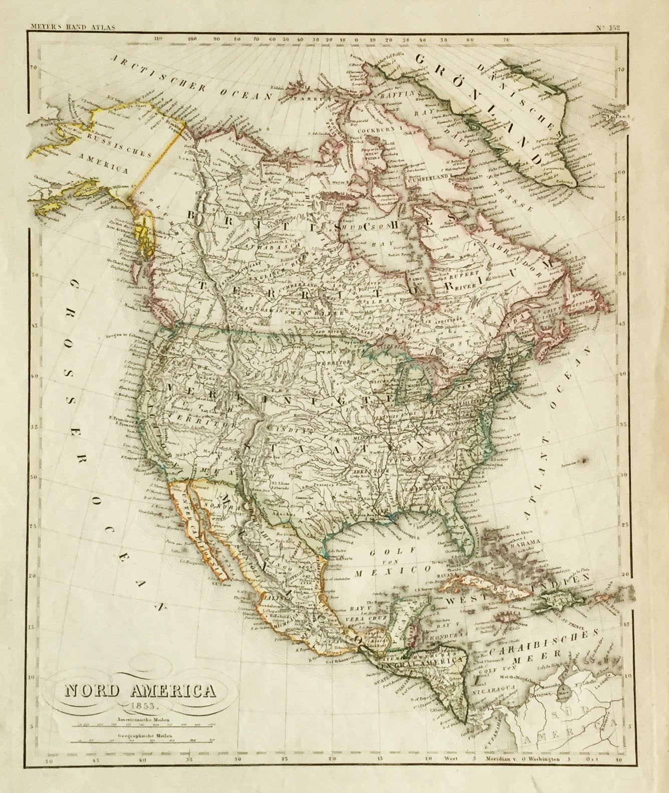
The superbly designed and colored map of North America from Meyer's Hand Atlas depicts the contiguous United States at the point when it has reached its full dimensions (except for the Gadsden Purchase of 1853, which is still not reflected here). Elsewhere, Alaska is still Russian and the Central American states are still shown as a single confederation. Please check our homepage for currently available maps.
Item Number: rs1398
Cartographer: Bibliographischen Instituts.
Place & Date: Hildburghausen / 1853
Size: 11 3/4" x 14 3/8"
Condition: original color; overall age toning, some spotting in the margins
Price: SOLD