use +/- or mouse scrollwheel for magnification.
click here
for full-sized image.

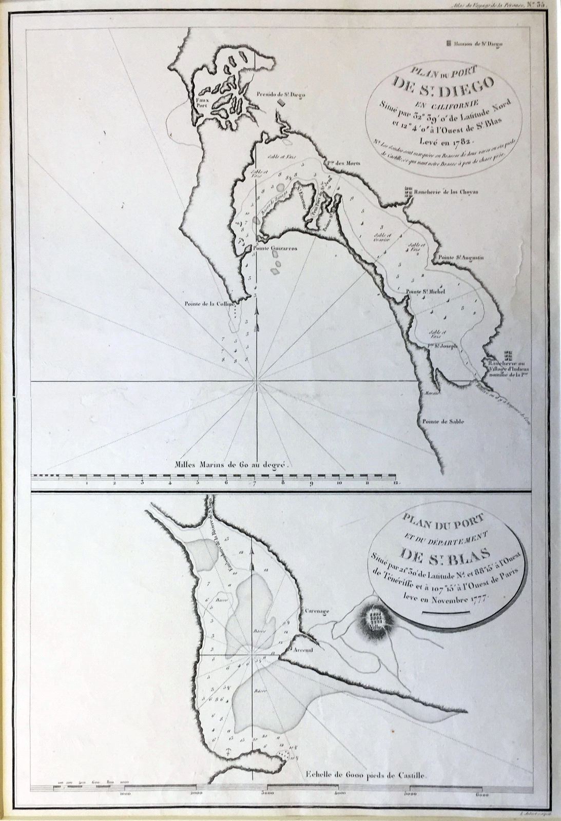
Plan du Port de St. Diego en Californie/Plan du Port et du Department de St. Blas
This item has been sold.
Please check our homepage for currently available maps.
Plate 35 from the Atlas volume of La Perouse's landmark Voyage autour du Monde, showing the port of San Diego in California and the port of San Blas in Mexico. An important early San Diego item. Please check our homepage for currently available maps.
Item Number: pb1229
Cartographer: La Perouse
Place & Date: Paris / 1797
Size: 19 1/2" x 13 1/4"
Condition: b&w; expert (and nearly invisible) repair at center of map.
Price: SOLD