use +/- or mouse scrollwheel for magnification.
click here
for full-sized image.

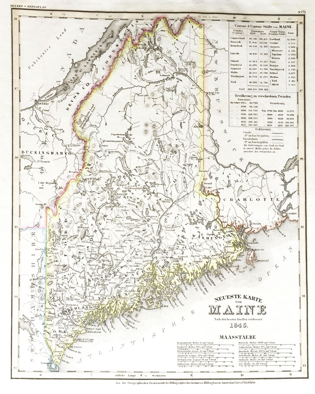
Neueste Karte von Maine
This item has been sold.
Please check our homepage for currently available maps.
The beautifully detailed and colored map of Maine from the 1845 edition of Meyer's Hand-Atlas. Includes lists of county and county-town populations. Please check our homepage for currently available maps.
Item Number: ns1596
Cartographer: Bibliographischen Instituts.
Place & Date: Hildburghausen / 1845
Size: 11 3/4" x 14 5/8"
Condition: original outline color; light overall age toning, a few spots in margins
Price: SOLD