use +/- or mouse scrollwheel for magnification.
click here
for full-sized image.

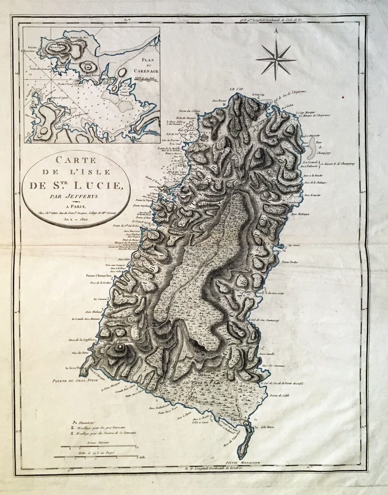
Carte de l'Isle de Ste. Lucie par Jefferys
This item has been sold.
Please check our homepage for currently available maps.
The later French edition of Jefferys' large-scale map of St. Lucia with dramatic topography, a key to plantations and harbors, and an inset chart of the bay and town of Le Carenage, today's Castries, St. Lucia's capital. Please check our homepage for currently available maps.
Item Number: gg1213
Cartographer: Dien
Place & Date: Paris / 1802
Size: 17 3/4" x 23"
Condition: some folding and wrinkling along outer edge of wide margins
Price: SOLD