use +/- or mouse scrollwheel for magnification.
click here
for full-sized image.

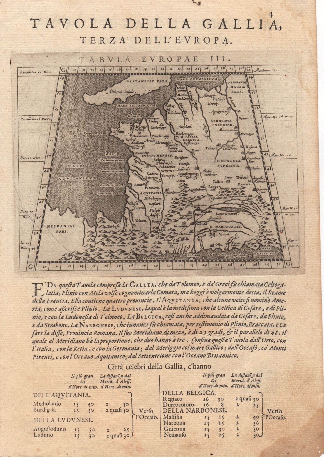
Tavola della Gallia, Terza dell'Europa Tavola della Gran Germania, Quarta dell'Europa
This item has been sold.
Please check our homepage for currently available maps.
The Ptolemaic maps of France ("the third of Europe") and, on the verso, of Germany (the fourth), from Magini's Geografia, published by Galignani Fratelli and engraved by Girolamo Porro. The text block under each map outlines the country's location and boundaries and includes a list of famous cities. Please check our homepage for currently available maps.
Item Number: RS2825
Cartographer: Magini / Porro / Galignani Fratelli
Place & Date: Venice / 1598
Size: 6 5/8" x 5 1/8" (maps); 7 3/4" x 11 1/8" (overall sheet)
Condition: b&w; overall age toning; marginal stains
Price: SOLD