use +/- or mouse scrollwheel for magnification.
click here
for full-sized image.

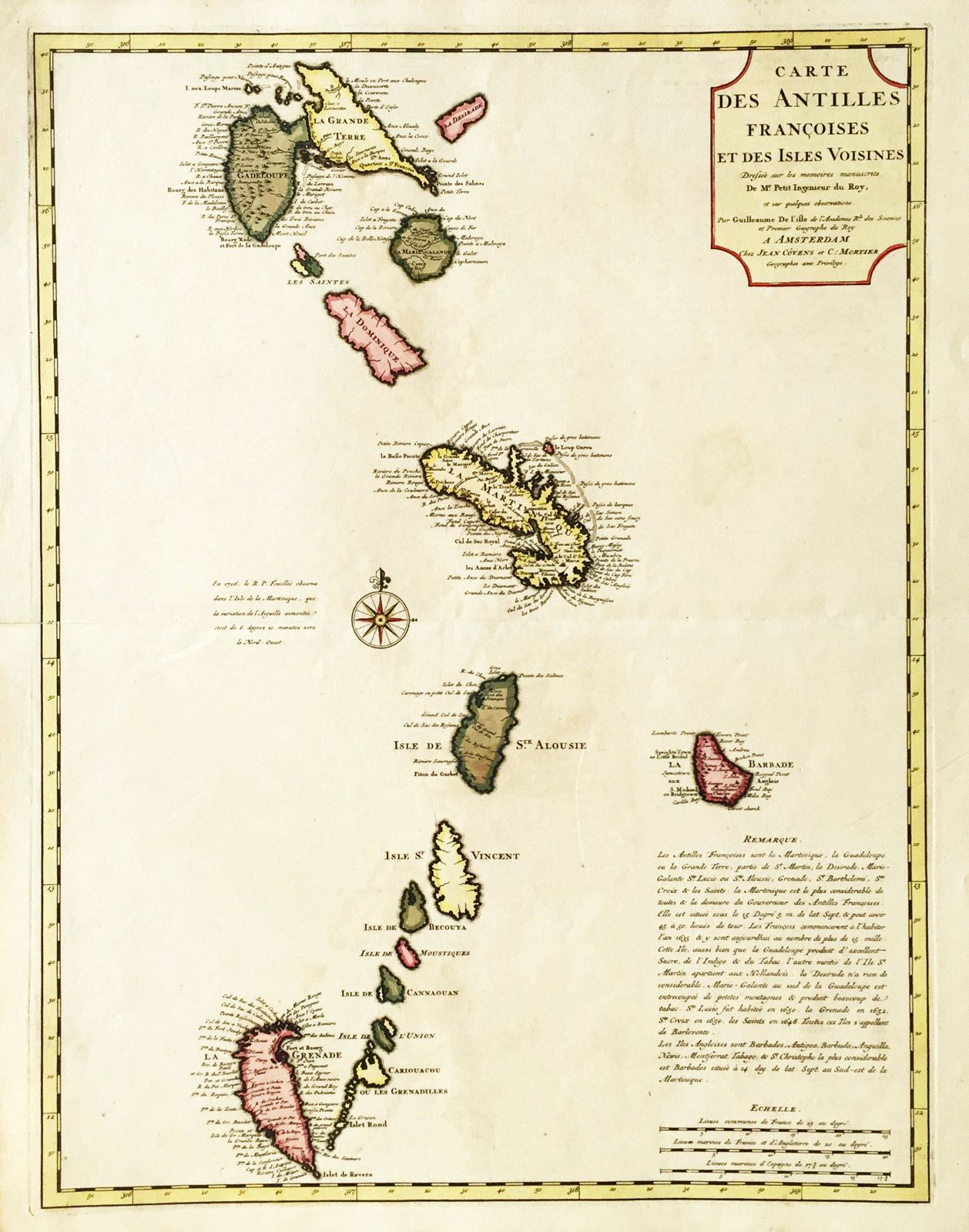
Carte des Antilles Francoises et des Isles Voisines
This item has been sold.
Please check our homepage for currently available maps.
A later Dutch edition of de l'Isle's superb map of the Lesser Antilles from Guadeloupe to Grenada. The text at the lower right corner is a brief overview of French involvment in the islands. A beautifully preserved and colored exemplar Please check our homepage for currently available maps.
Item Number: RS2709
Cartographer: de l'Isle / Covens & Mortier
Place & Date: Amsterdam / 1730
Size: 17 5/8" x 23 1/4"
Condition: original wash color; light overall age toning; repaired split along left margin centerfold
Price: SOLD