use +/- or mouse scrollwheel for magnification.
click here
for full-sized image.

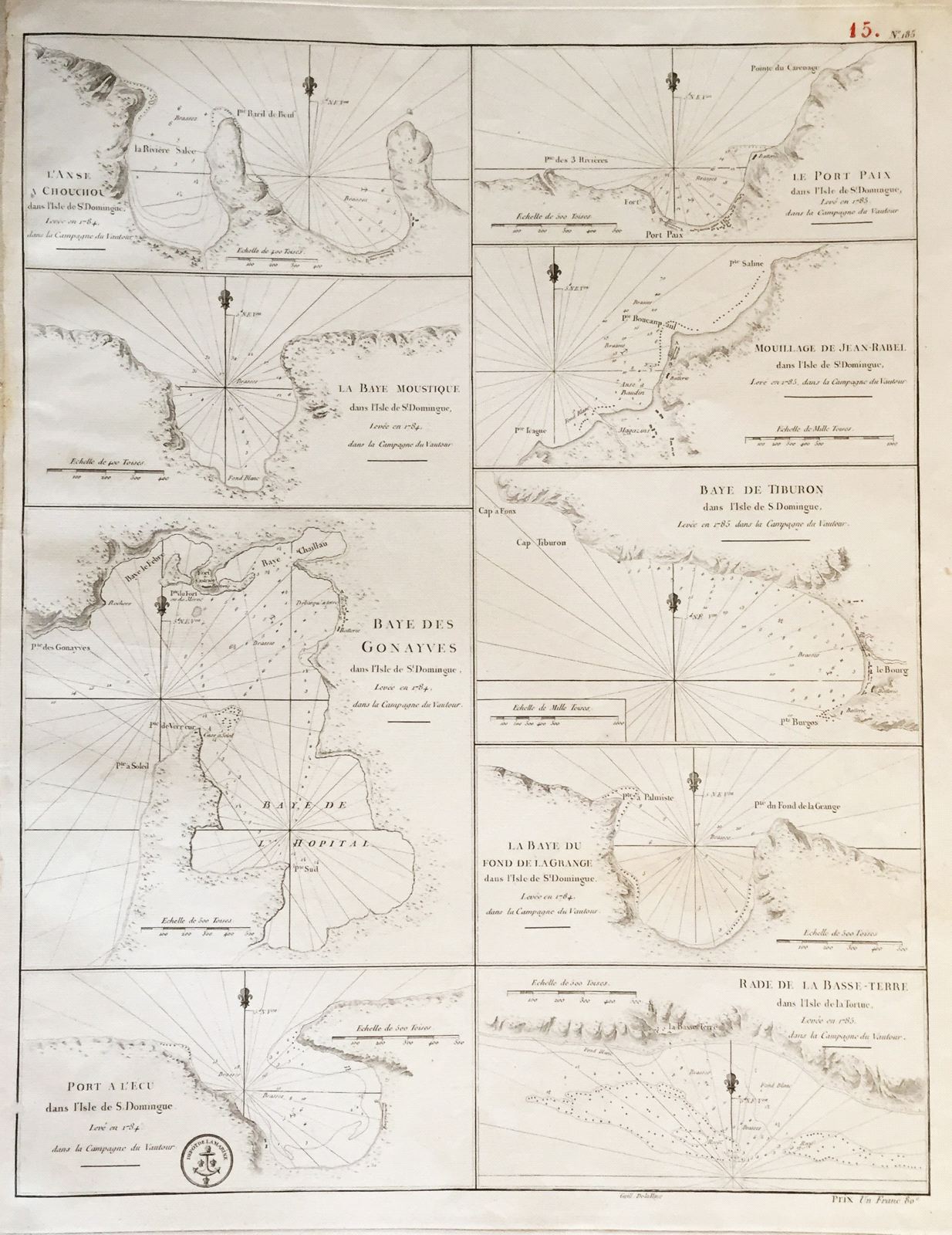
L'Anse a Chouchou; Le Port Paix; Mouillage de Jean- Rabel; La Baye Moustique; Baye de Tiburon; Baye des Gonayves; La Baye du Fond de la Grange; Port a l'Écu; rade de la Basse-Terre
This item has been sold.
Please check our homepage for currently available maps.
Seven sea-charts of bays and harbors along the coasts of Hispaniola and Tortuga, on a large sheet engraved by Dela Haye for the French Dépôt de la Marine. The composite chart is based on the French coastal survey of Hispaniola in 1784 and shows multiple depth soundings, anchorages and great navigational detail. A scarce and important St. Domgingue/Haiti item Please check our homepage for currently available maps.
Item Number: RS2660
Cartographer: Delahaye / Dépôt de la Marine
Place & Date: Paris / 1787
Size: 17 1/2" x 22 5/8"
Condition: b&w; overall age toning; some browning and fraying along outer edges of margins
Price: SOLD