use +/- or mouse scrollwheel for magnification.
click here
for full-sized image.

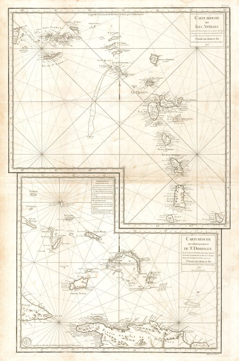
Carte reduite des Iles Antilles/Carte reduite des debouquements de St. Domingue
This item has been sold.
Please check our homepage for currently available maps.
An impressive two-in-one map of the Lesser Antilles (from the eastern tip of Puerto Rico and the Virgin Islands to St. Vincent and Barbados) and of the "debouquements" (navigational channels) of St. Domingue, encompassing the north coast of Hispaniola (St. Domingue), the Turks and Caicos islands and the southern Bahamas. A later reissue and compilation of two key Caribbean maps by the prolific French cartographer Bellin. Please check our homepage for currently available maps.
Item Number: RS2605
Cartographer: Verdun de la Crenne
Place & Date: Paris / 1775
Size: 22 1/4" x 34 1/4"
Condition: b&w; overall age toning; some spotting, mostly in the margins; some creases along centerfold
Price: SOLD