use +/- or mouse scrollwheel for magnification.
click here
for full-sized image.

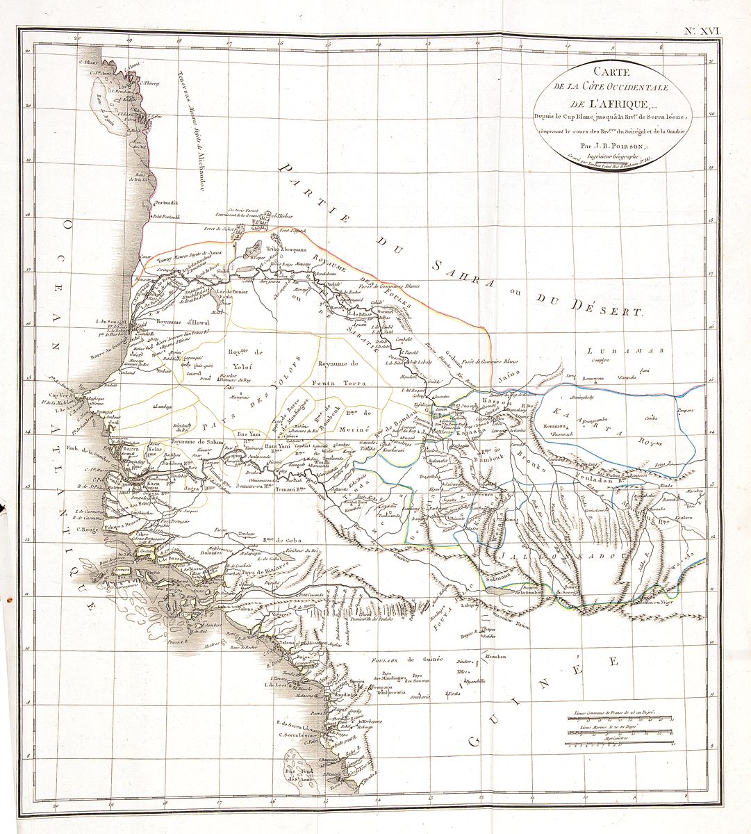
Carte de la Cote Occidentale de l’Afrique, Depuis le Cap Blanc Jusqu’a La Riv. De Serra Leonne
This item has been sold.
Please check our homepage for currently available maps.
A beautifully colored and well preserved exemplar of Poirson's fascinating map of the west coast of Africa encompassing all or part of current day Mauritania, Senegal, Gambia, Guinea-Bissau, Guinea, and Sierra Leone. Includes many topographical details and the borders of west African kingdoms. From the atlas volume of the Statistique générale et particulière de la France et de ses colonies, published by F. Buisson. Please check our homepage for currently available maps.
Item Number: RS2387
Cartographer: Poirson//Tardieu
Place & Date: Paris / 1803/1804
Size: 15" x 16 3/8"
Condition: folding map; outline color; very light overall age toning; some wrinkling along folds and minor nicks along edge of right margin
Price: SOLD