use +/- or mouse scrollwheel for magnification.
click here
for full-sized image.

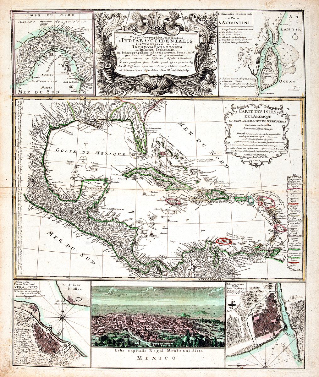
Mappa Geographicae, complectens Indiae Occidentalis/ Carte des Isles de l'Amerique.
This item has been sold.
Please check our homepage for currently available maps.
An extraordinary composite map consisting of, in the center, d'Anville's superb West Indies map from Charlevoix's Histoire de Saint Domingue, surrounded by inset maps of San-Domingo, Vera Cruz, the Isthmus of Panama, and St. Augustine, and a magnificent bird's-eye view of Mexico City. At the top of the sheet, between the Panama and St. Augustine insets is a sumptuous cartouche depicting palm fronds, tobacco bales, cornucopias, and an Indian king and queen. Please check our homepage for currently available maps.
Item Number: RS2369
Cartographer: Homann Heirs/J.B.B. d'Anville
Place & Date: Nurnberg / 1740
Size: 19" x 22 5/8"
Condition: Main West Indies map in outline color; wash color in inset maps; light overall age toning and minor browning and spotting mostly in the margins
Price: SOLD