use +/- or mouse scrollwheel for magnification.
click here
for full-sized image.

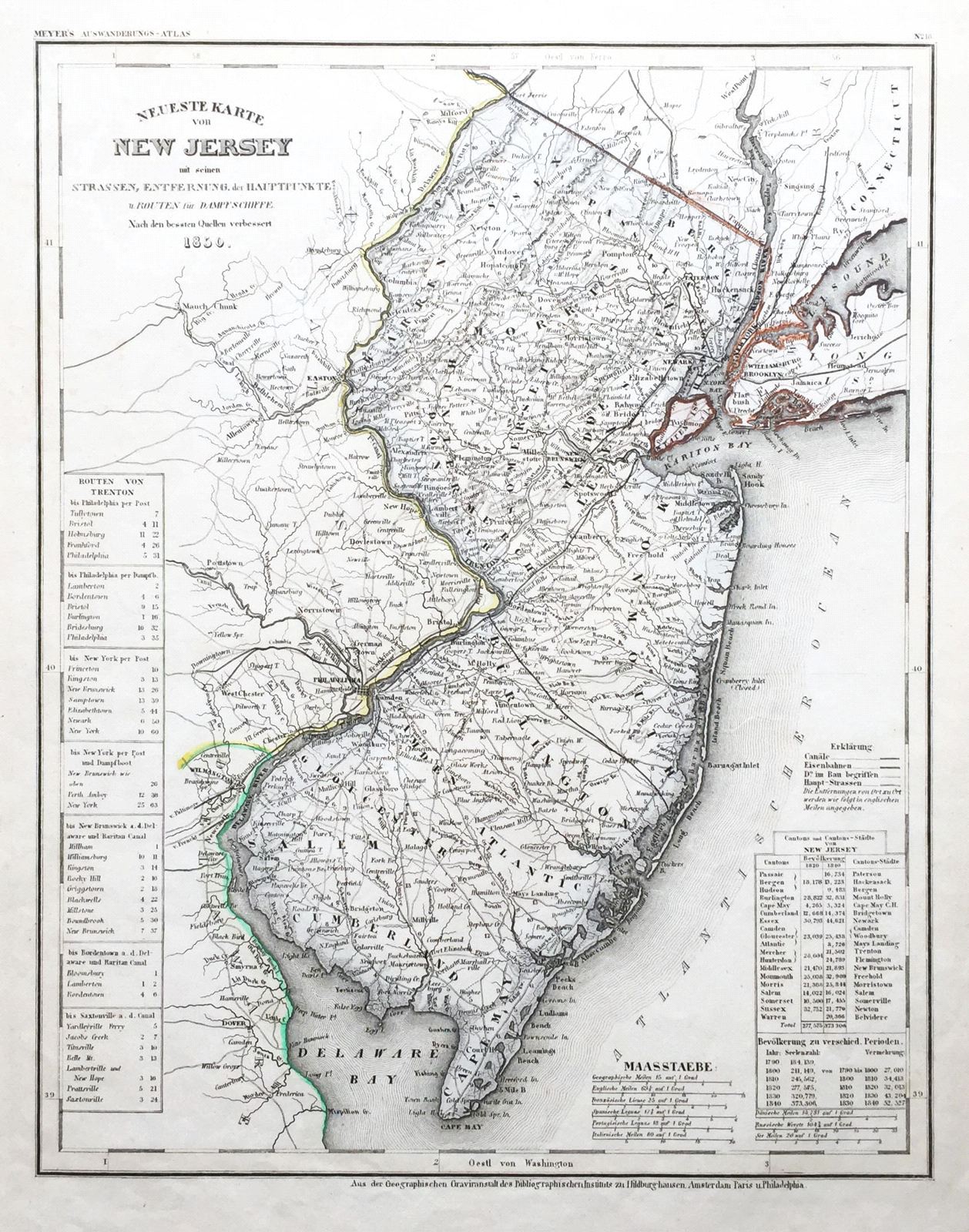
Neueste Karte von New Jersey 1850
This item has been sold.
Please check our homepage for currently available maps.
The beautifully detailed and colored map of New Jersey "with its streets, distances between main towns, and steamship routes" from Meyer's Auswanderungs-Atlas (Emigrant's Atlas) of North America. Includes a key to canals, railroads, and main roads as well as distances "by post" and "by steamship" between Trenton and Philadelphia, Trenton and New York, etc. Please check our homepage for currently available maps.
Item Number: RS2173
Cartographer: Joseph Meyer/Bibliographischen Instituts.
Place & Date: Hildburghausen / 1849/1857
Size: 12 3/4" x 14 1/2"
Condition: original color; overall age toning and some spotting along left margin
Price: SOLD