use +/- or mouse scrollwheel for magnification.
click here
for full-sized image.

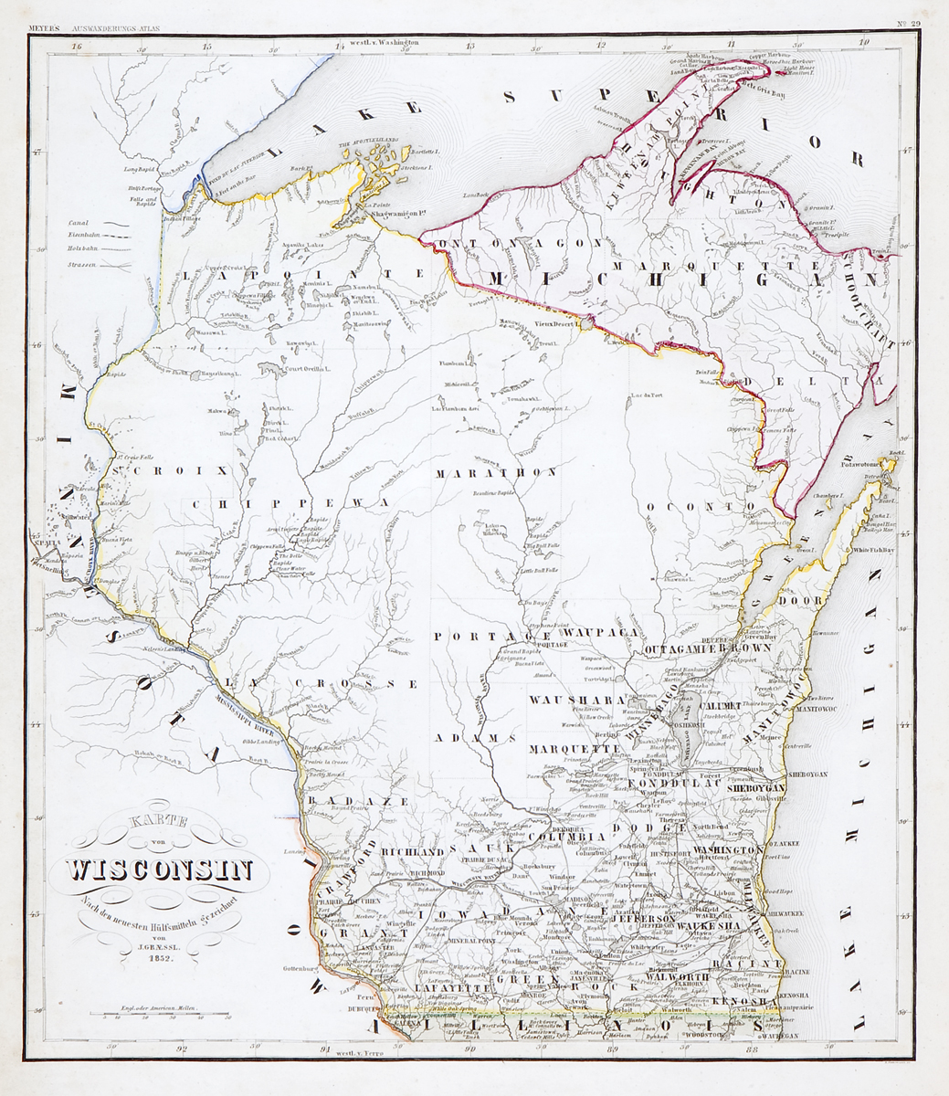
Karte von Wisconsin 1852
This item has been sold.
Please check our homepage for currently available maps.
A scarce and beautifully detailed and colored map of mid-19th century Wisconsin from Meyer's Auswanderungs-Atlas (Emigrant's Atlas) of North America. Please check our homepage for currently available maps.
Item Number: RS2170
Cartographer: J. Graessl. / Bibliographischen Instituts.
Place & Date: Hildburghausen / 1849/1857
Size: 12 3/8" x 14 1/2"
Condition: original outline color; light overall age toning
Price: SOLD