use +/- or mouse scrollwheel for magnification.
click here
for full-sized image.

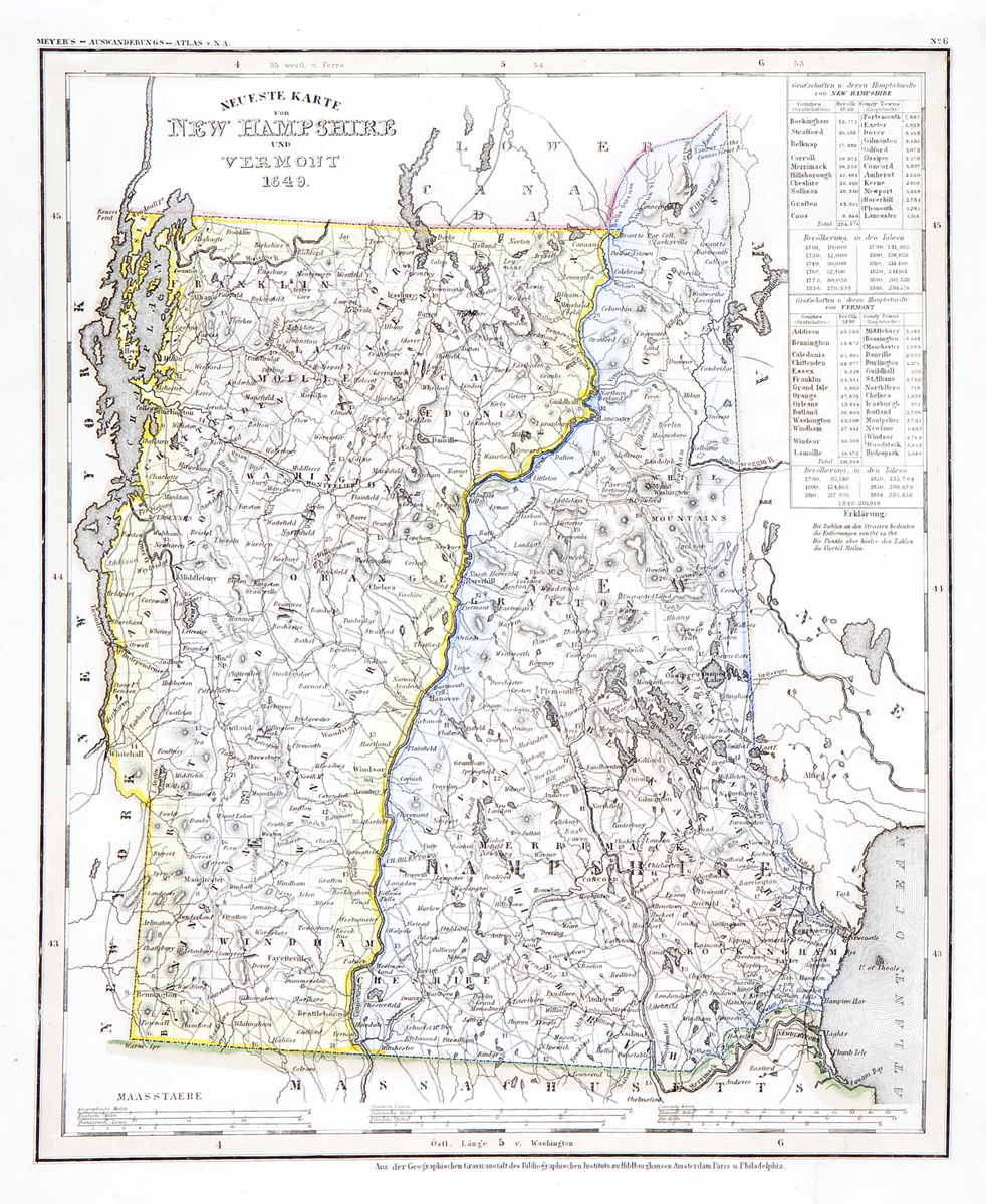
Neueste Karte von New Hampshire und Vermont 1849
This item has been sold.
Please check our homepage for currently available maps.
The beautifully detailed and colored map of New Hampshire and Vermont, from Meyer's Auswanderungs-Atlas (Emigrant's Atlas) of North America. Includes inset boxes listing county and "county town" populations. Please check our homepage for currently available maps.
Item Number: RS2167
Cartographer: Joseph Meyer/Bibliographischen Instituts.
Place & Date: Hildburghausen / 1849/1857
Size: 11 3/4" x 14 3/4"
Condition: well preserved exemplar in original outline color
Price: SOLD