use +/- or mouse scrollwheel for magnification.
click here
for full-sized image.

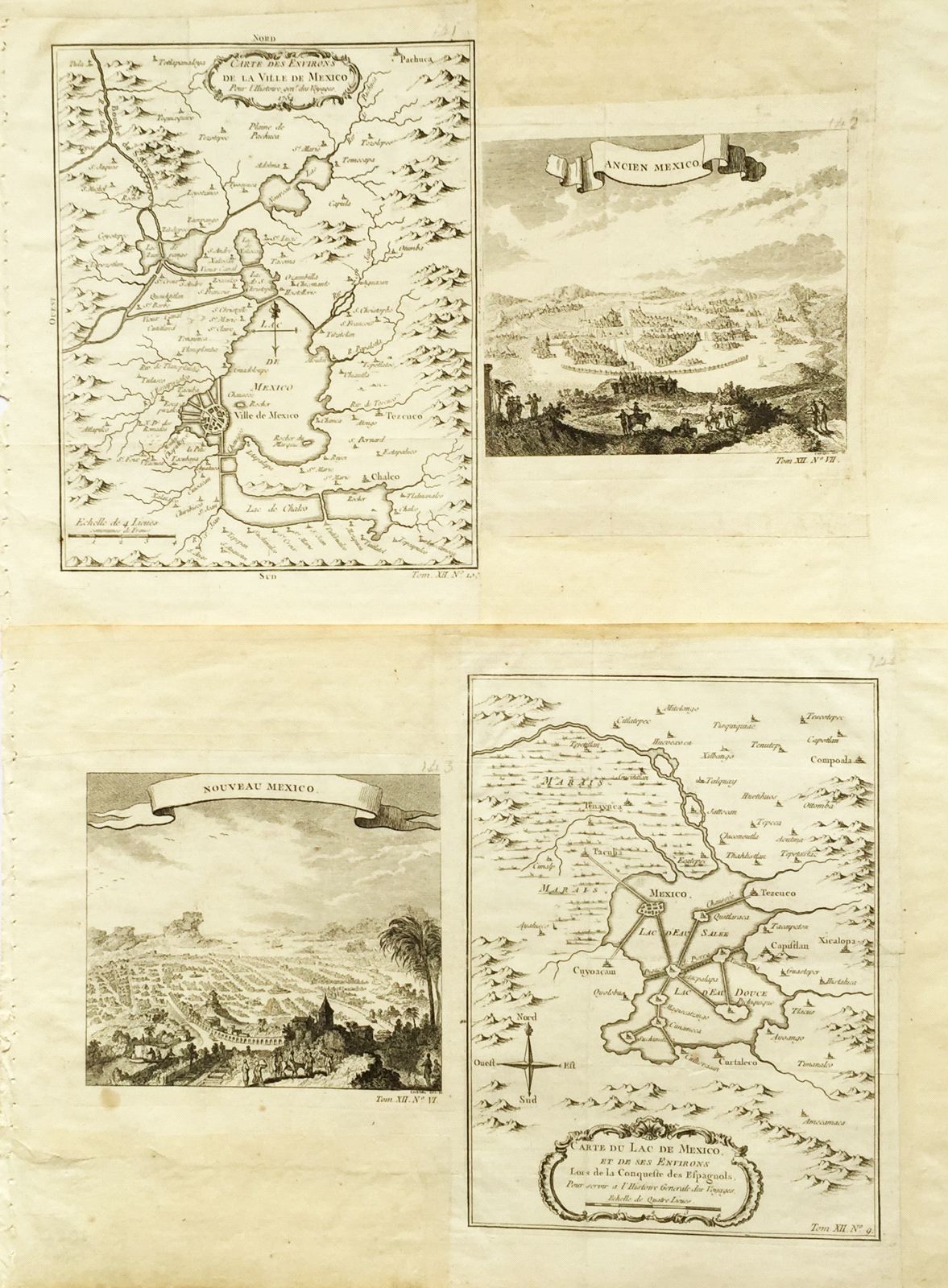
Carte des Environs de la Ville de Mexico / Ancien Mexico [and on a second sheet] Nouveau Mexico / Carte du lac de Mexico et de ses Environs
This item has been sold.
Please check our homepage for currently available maps.
Four Mexico City maps and views on two sheets from the atlas of Prevost d'Exiles' influential travel book, Histoire Generale des Voyages. On the first sheet is Bellin's highly detailed map of Mexico City and the Valley of Mexico, with many place names and topographical features, and next to it, Chedel's lovely, evocative view of Old Mexico City just after the Spanish conquest engraved. On the second sheet is the companion view of New Mexico City, showing the results of Spanish drainage and waterworks projects, and next to it, Bellin's equally well detailed map of the Lake of Mexico and its environs "at the time of the Spanish conquest" before much of the lake and surrounding marshes were drained. Please check our homepage for currently available maps.
Item Number: RS2082
Cartographer: Bellin / Chedel
Place & Date: Paris / 1754/1760
Size: 6 1/4" x 8 1/8" (Environs); 6" x 8 1/2" (Lac); 6 3/8" x 4 3/4" (Ancien & Nouveau Mexico)
Condition: b&w; light overall age toning; a few spots in the margins; margins extended with contemporary paper to fit the size of the atlas volume
Price: SOLD