use +/- or mouse scrollwheel for magnification.
click here
for full-sized image.

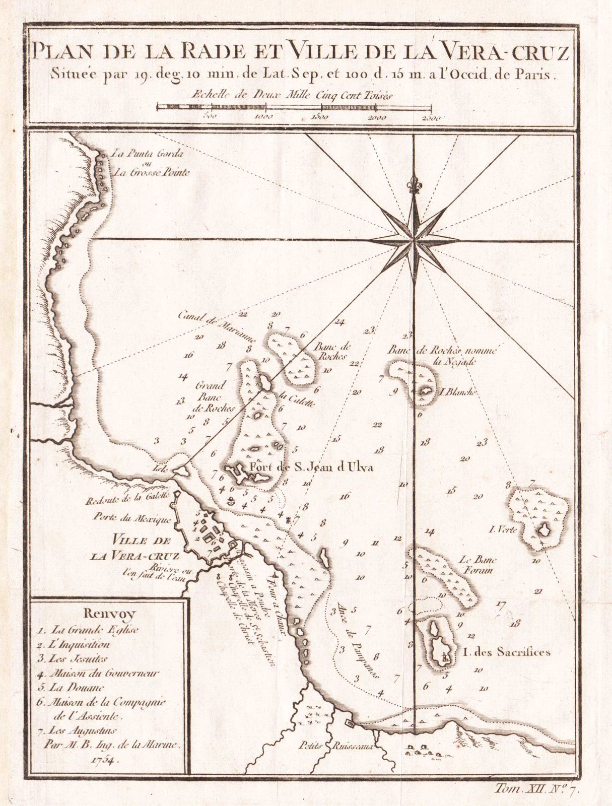
Plan de la Rade et Ville de la Vera-Cruz
This item has been sold.
Please check our homepage for currently available maps.
Bellin's highly detailed chart of the city and anchorages of Veracruz and its surroundings, including the fort of San Juan de Ulua, with many depth soundings, topographical and nautical details, and a number key to major city landmarks; from the atlas of Prevost d'Exile's Histoire Generale des Voyages. Please check our homepage for currently available maps.
Item Number: RS2081
Cartographer: Bellin
Place & Date: Paris / 1754/1760
Size: 6 1/8" x 8 1/4"
Condition: b&w; overall age toning; a few spots in the margins; margins extended with contemporary paper to fit the size of the atlas volume
Price: SOLD