use +/- or mouse scrollwheel for magnification.
click here
for full-sized image.

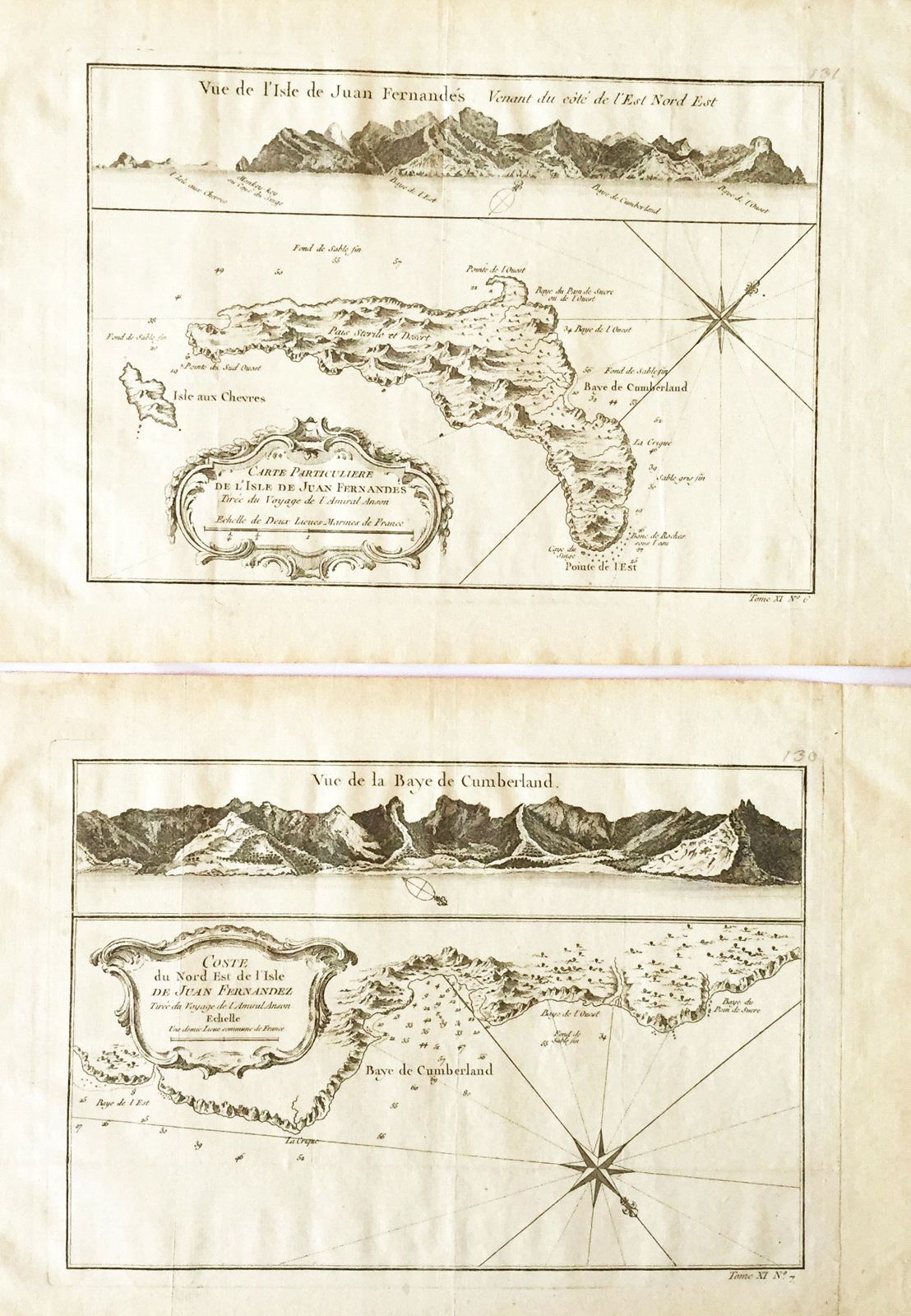
Carte Particuliere de l'Isle de Juan Fernandes [and on a separate sheet] Coste du Nord Est de l'Isle de Juan Fernandez [Robinson Crusoe Island]
This item has been sold.
Please check our homepage for currently available maps.
A pair of maps of Juan Fernandez Island, known today as Robinson Crusoe Island, off the coast of Chile, from the atlas of Prevost d'Exiles' influential travel book, Histoire Generale des Voyages. It was here that Alexander Selkirk was marooned in 1704, providing the inspiration for Daniel Defoe's Robinson Crusoe. The beautifully designed Carte Particuliere is a detailed map of the entire island, based on Anson's surveys in the 1740s, with good topographical detail, many depth soundings, a decorative cartouche and compass rose, and above the map, a profile of the island's northeast coast. The second map is a plan of the northeast coast of the island, centered on the Bay of Cumberland, with a view of the bay at the top of the sheet. Please check our homepage for currently available maps.
Item Number: RS2072
Cartographer: Bellin
Place & Date: Paris / 1754/1760
Size: 10 7/8" x 7 5/8" (Carte); 11" x 7 1/2" (Coste)
Condition: b&w; light overall age toning
Price: SOLD