use +/- or mouse scrollwheel for magnification.
click here
for full-sized image.

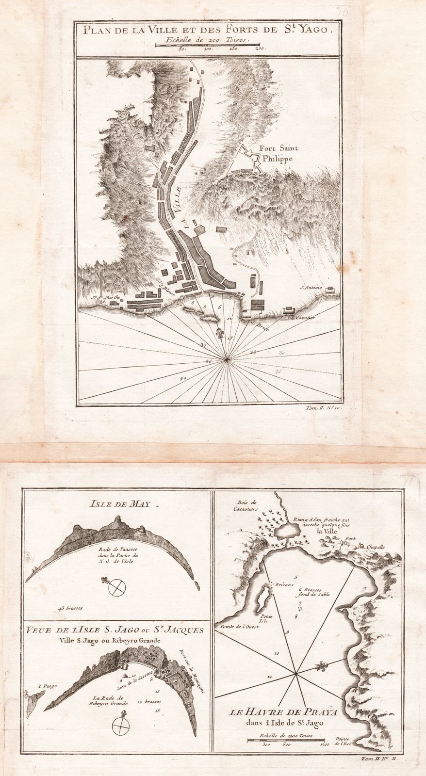
Plan de la Ville et des Forts de St. Yago [and on a second sheet] Isle de May/Veue de l'Isle S. Jago ou St. Jacques/Le Havre de Praya dans l'Isle de St. Jago [all Cape Verde Islands]
This item has been sold.
Please check our homepage for currently available maps.
Four plans and views of sites on the Portuguese Cape Verde islands, off the northwest coast of Africa, on two sheets from the atlas of Prevost d'Exiles' influential travel book, Histoire Generale des Voyages. On the first sheet is Bellin's detailed plan of the city of St. Yago (today's Praia, capital of the Cape Verde islands) and its fort of Saint Philippe on the island of St. Yago (Sao Tiago). On the second sheet are coastal profiles of the Isle de May (Maio island) and Ile S. Jago (Yago, or Sao Tiago), next to a plan of the harbor of St. Jago (Praya, or Praia) on the island of the same name. Please check our homepage for currently available maps.
Item Number: RS2066
Cartographer: Bellin
Place & Date: Paris / 1746/1760
Size: 5 5/8" x 8 1/8" (St. Yago plan); 8 1/8" x 4 1/8" (three views/plans)
Condition: b&w; overall age toning and some spotting, mostly in the wide margins; margins extended with contemporary paper to fit the size of the atlas volume
Price: SOLD