use +/- or mouse scrollwheel for magnification.
click here
for full-sized image.

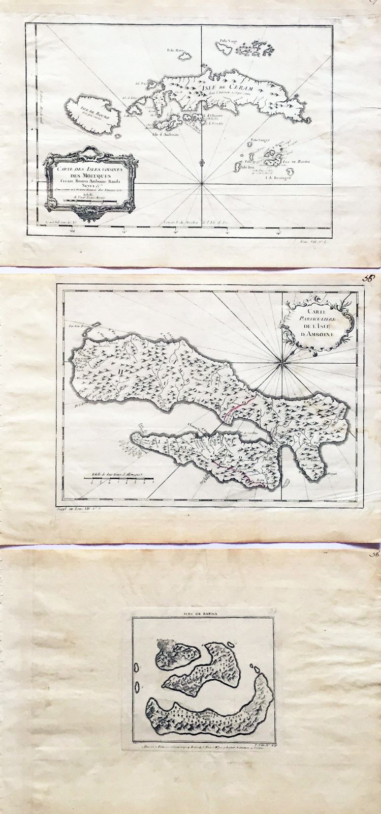
Carte des Isles voisines des Moluques Ceram, Bouro, Amboine, Banda, Neyra etc [and] Carte Particuliere de l'Isle d'Amboine [and] Isle de Banda
This item has been sold.
Please check our homepage for currently available maps.
A set of three maps of the "islands neighboring the Moluccas" (Maluku Islands in present day Indonesia) from the atlas of Prevost d'Exiles' influential collection of travel narratives, Histoire Generale des Voyages. The first map encompasses the islands of Bouro (Buru), Ceram (Seram), Amboine (Ambon), and the Banda Islands. The second map is a large detailed map of Ambon island; the third is small but even more detailed map of the Banda islands, with a number key to the islands' names and a volcano erupting on Gunnanape Island (Gunung Api). Please check our homepage for currently available maps.
Item Number: RS1996
Cartographer: Bellin
Place & Date: Paris / 1750/1760
Size: 11 5/8" x 8" (Isles voisines); 11 3/4" x 8 1/2" (Amboine); 4" x 5 1/4" (Banda)
Condition: b&w; light overall age toning; large, but light water stain on right side of "voisines" and Amboine maps; margins extended with contemporary paper to fit the size of the atlas volume
Price: SOLD