use +/- or mouse scrollwheel for magnification.
click here
for full-sized image.

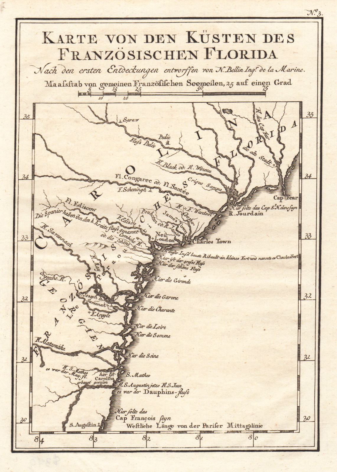
Karte von den Kusten des Franzoisischen Florida
This item has been sold.
Please check our homepage for currently available maps.
Bellin's very interesting map of the coast of "French Florida," comprising northern Florida, Georgia, and the Carolinas, from St. Augustine to Cape Fear. From a German edition of Charlevoix's Histoire . . . de la Nouvelle France. Note names of French rivers transferred to the New World: Gironde, Garone, Charonte, Loire, Somme, and Seine. Please check our homepage for currently available maps.
Item Number: G725
Cartographer: Bellin
Place & Date: Leipzig / 1756
Size: 5 3/4" x 8"
Condition: b&w; light overall age toning
Price: SOLD