use +/- or mouse scrollwheel for magnification.
click here
for full-sized image.

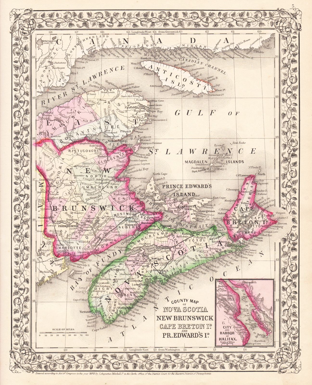
County Map of Nova Scotia New Brunswick Cape Breton Id. and Pr. Edward's Id.
This item has been sold.
Please check our homepage for currently available maps.
The beautifully detailed and colored map of the Canadian Maritime Provinces from the 1870 edition of Mitchell's popular New General Atlas of the world. Framed by the vine motif border typical of Mitchell maps of the mid-1860s to 1881, the map includes an inset of the "City and Harbor of Halifax," capital of Nova Scotia. Please check our homepage for currently available maps.
Item Number: G2724
Cartographer: S. A. Mitchell
Place & Date: Philadelphia / 1870
Size: 10 5/8" x 13 3/8"
Condition: wash color; overall age toning
Price: SOLD