use +/- or mouse scrollwheel for magnification.
click here
for full-sized image.

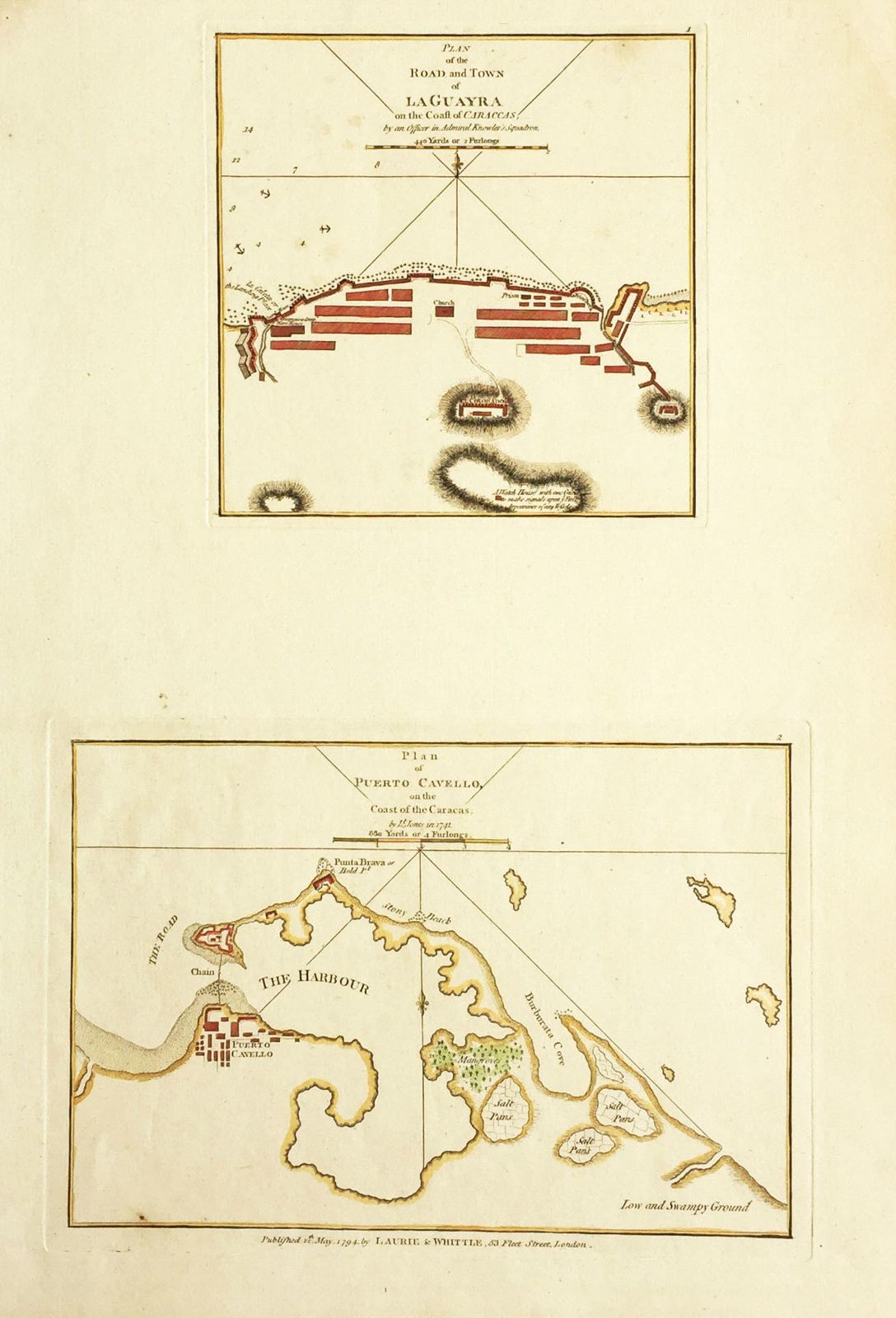
Plan of the Road and Town of La Guayra on the Coast of Caraccas / Plan of Puerto Cavello on the Coast of the Caracas
This item has been sold.
Please check our homepage for currently available maps.
A scarce sheet from Laurie & Whittle's West India Atlas with plans of two major Venezuelan ports. At top is a detailed chart of La Guayra (the port of Caracas), showing fortified walls and major buildings, and rocks, shoals and anchorages in the surrournding waters. The plan was made by "an officer in Admiral Knowles Squadron" part of an unsuccessful British attack on the port during the War of Jenkin's Ear in 1743. The second chart is of Puerto Cabello harbor on the central coast of Venezuela (near Valencia), also unsuccessfully attacked by Knowles. Among the labeled features are salt pans, a mangrove, a "stony beach," and "low and swampy ground." Please check our homepage for currently available maps.
Item Number: G2637
Cartographer: Laurie & Whittle
Place & Date: London / 1797
Size: 7" x 7" (La Guayra); 10 3/8" x 7 3/8" (Puerto Cabello)
Condition: wash color; minor spotting and marginal soiling
Price: SOLD