use +/- or mouse scrollwheel for magnification.
click here
for full-sized image.

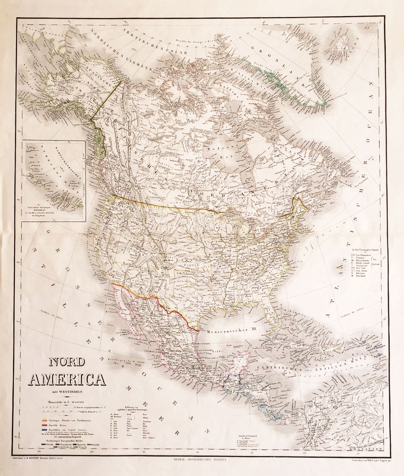
Nord America mit Westindien
This item has been sold.
Please check our homepage for currently available maps.
A superbly engraved and colored map of North America and the West Indies with a host of place names and meticulously rendered topography. Includes an inset of the Aleutian Islands, a color key to the continent's republics and European colonies, a glossary of English and Spanish geographical terms, a list of Mexico's tallest mountains, and a key to the abbreviations of the New England and Middle Atlantic states. Please check our homepage for currently available maps.
Item Number: G1049
Cartographer: Geographisches Institut. / Kieppert & Graf
Place & Date: Weimar / 1857/1859
Size: 20" x 23 1/2"
Condition: outline color; light overall age toning
Price: SOLD