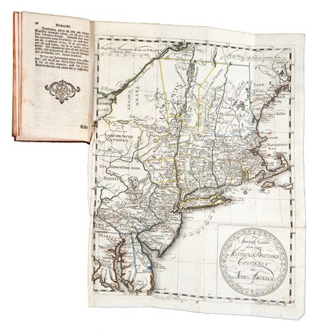

Beschreibung des Brittischen Amerika zur Ersparung der englischen Karten/Special Karte von den Mittleren Brittishen Colonien in Nord Amerika
This item has been sold.
Please check our homepage for currently available maps.
Christian Leiste's German-language "Description of British America," with a beautifully preserved exemplar of the scarce "Special Map of the Middle British Colonies in North America." Engraved in Hamburg by Pingeling, the highly detailed map of the northeastern seaboard of what is now the United States extends from Montreal to Chesapeake Bay and includes a large and decorative title cartouche in the lower right corner. Please check our homepage for currently available maps.
Item Number: B1905
Cartographer: Leiste / Pingeling
Place & Date: Braunschweig / 1778
Size: 4 1/8" x 6 7/8" (overall volume); 12" x 15" (map)
Condition: original gold-stamped leather binding, worn and scuffed but intact; overall age toning; folding map in outline color, with some minor spotting and creasing.
Price: SOLD