
use +/- or mouse scrollwheel for magnification. click here for full-sized image.
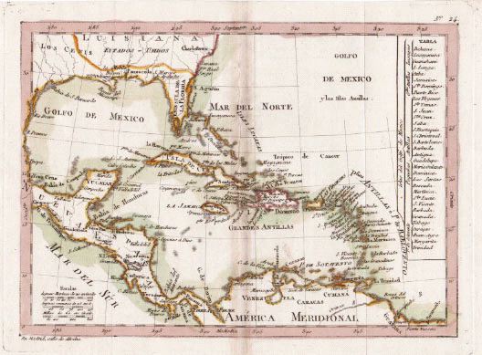
Golfo de Mexico y las Islas Antillas
This item has been sold. Please check our homepage for currently available maps.
A rare Spanish map of the West Indies by the Spanish Royal cartographer Tomas Lopez. The map extends from "Charlestown," South Carolina (labelled "Luisiana") to northern South America. Includes a key to the various groups of Caribbean islands (Greater and Lesser Antilles, Lucayas, etc.) Item Number: rs1805
Cartographer: Tomas Lopez
Place & Date: Madrid / 1787
Size: 9 1/2" x 7"
Condition: outline and wash color; overall age toning, light browning along centerfold
Price: SOLD