
use +/- or mouse scrollwheel for magnification. click here for full-sized image.
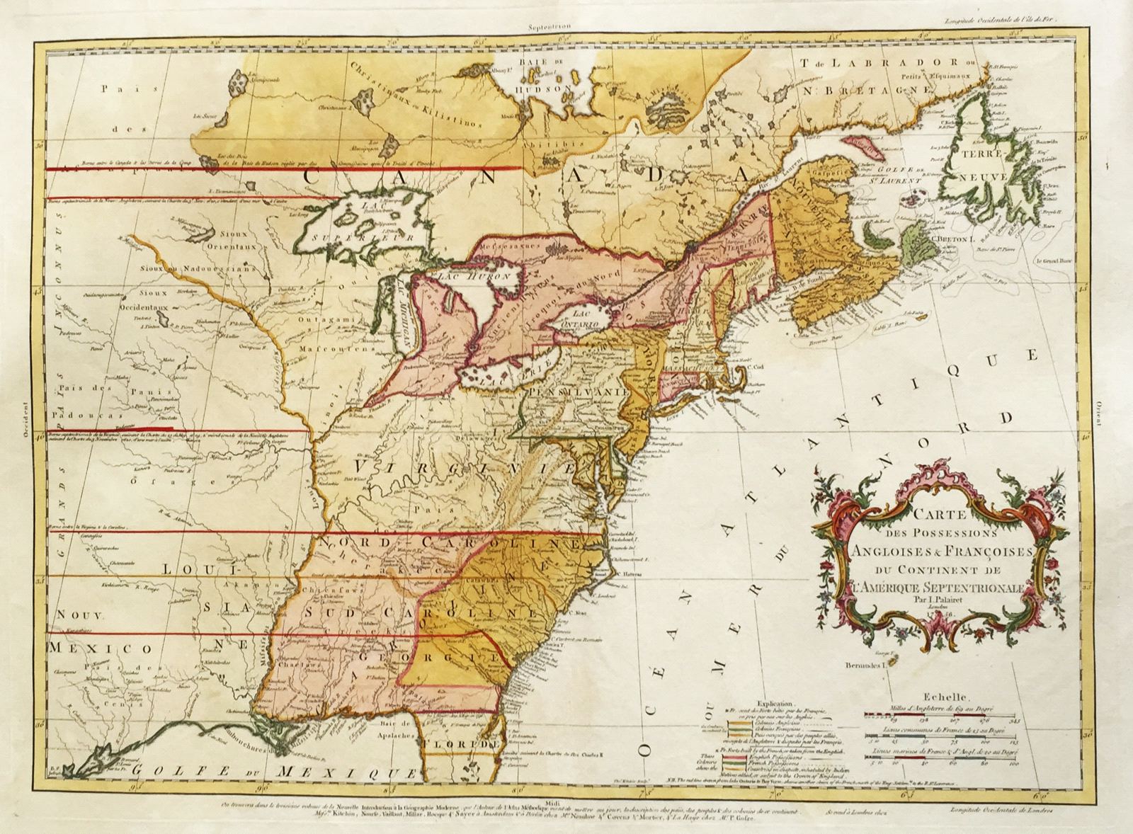
Carte des Possessions Angloises & Francoises du Continent de l'Amerique Septentrionale
This item has been sold. Please check our homepage for currently available maps.
The third edition of a fine and important map of eastern North America up to Hudson Bay, showing the conflicting claims of the French and English during the French and Indian War. Engraved by Kitchin, Palairet's map includes a bilingual "explication" (a color key to the territories claimed by both sides and shows the British claims west of the Mississippi. Item Number: rs1749
Cartographer: J. Palairet / Kitchin
Place & Date: London / 1756
Size: 22 3/4" x 17"
Condition: beautifully colored; overall age toning; washed and strenghthened; tear in lower margin centerfold expertly repaired
Price: SOLD