
use +/- or mouse scrollwheel for magnification. click here for full-sized image.
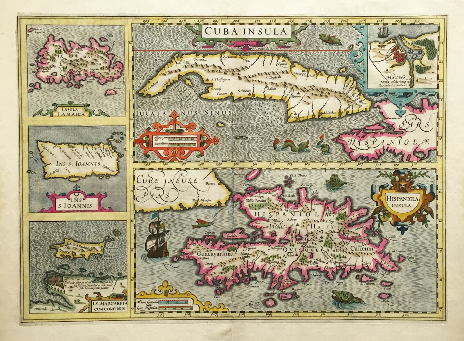
Cuba Insula/Hispaniola Insula
This item has been sold. Please check our homepage for currently available maps.
A French edition of the famous composite map of five West Indian islands from the Mercator/ Hondius Atlas, first published in 1606. The two main maps of Cuba and Hispaniola, each with a title cartouche and mileage scale, are flanked by four smaller maps of Jamaica, Puerto Rico (I. S. Ioannis), and Margarita Island off the coast of Venezuela. The Cuba map includes an inset plan of Havana. Item Number: rs1727
Cartographer: Mercator / Hondius
Place & Date: Amsterdam / 1628/1630
Size: 20" x 14 1/4"
Condition: wash color; overall age toning; light browning mostly along edges of wide margins; light dampstain on left margin; two small splits along fold in upper and lower margins
Price: SOLD