
use +/- or mouse scrollwheel for magnification. click here for full-sized image.
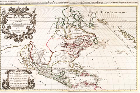
Amerique Septentrionale divisee en ses Principales Parties ou sont distingues les uns des autres Les Estats suivant qu'ils appartienent presentement, aux Francois, Castillanes, Anglois, Suedois, Danois, Hollandois . . . par le Sr. Sanson
This item has been sold. Please check our homepage for currently available maps.
A beautifully preserved exemplar of Jaillot's landmark Sanson-derived North America map, first published in 1674. The map is dominated by a giant California island and accurately renders the Gulf of Mexico and the east coast of the continent. Its unusual projection is known as the Sanson-Flamsteed projection. The mileage scale and title cartouches are superb examples of the 17th century engraver's art. Item Number: rs1410
Cartographer: Jaillot / Sanson
Place & Date: Paris / 1674/1696
Size: 34 1/4" x 22 1/4"
Condition: contemporary outline color; one or two minor spots
Price: SOLD