
use +/- or mouse scrollwheel for magnification. click here for full-sized image.
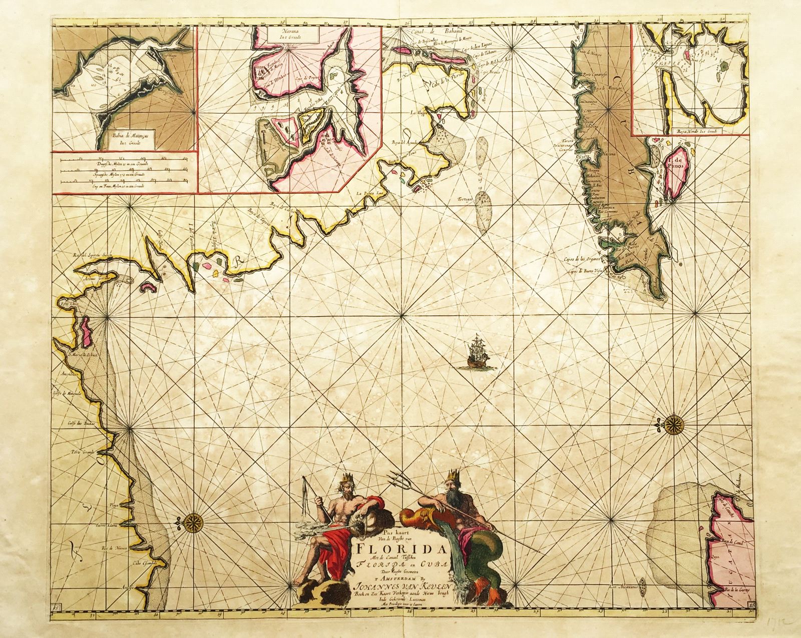
Pas kaart van de Boght van Florida met de Canaal tusschen Florida en Cuba
This item has been sold. Please check our homepage for currently available maps.
van Keulen's rare and dramatic chart of the "Bay of Florida and the channel between Florida and Cuba" is oriented with North to the right. Obscuring parts of Florida and Cuba are three inset charts of Cuban harbors: Matanzas, Havana, and Baja Hondo. This exemplar is the map's second state, with a shoal around the tip of the Yucatan added. Item Number: rs1299
Cartographer: van Keulen
Place & Date: Amsterdam / 1700
Size: 23 1/4" x 20"
Condition: Full contemporary color, with the green oxidized. Overall browning and spotting, small waterstains throughout. Repaired splits in centerfold margins. Backed.
Price: SOLD