
use +/- or mouse scrollwheel for magnification. click here for full-sized image.
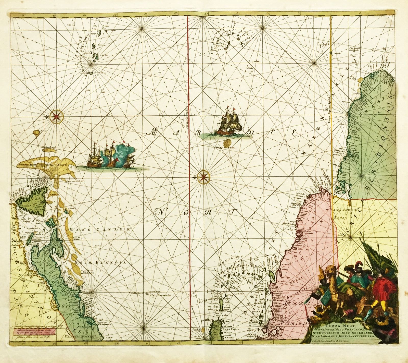
Terra Neuf
This item has been sold. Please check our homepage for currently available maps.
R. & J. Ottens' later edition of de Wit's magnificent Atlantic map, oriented with North to the right and showing the coasts of New France, New England, New Andalucia, Venezuela, and Guiana, as well as the Caribbean Islands from eastern Hispaniola to Trinidad, and the Atlantic all the way to the Azores and Cape Verde Islands. The dramatic cartouche shows European colonizers, Indian chieftains, and a cornucopia of New World fauna and products. A beautifully preserved exemplar in splendid original color. Item Number: rs1293
Cartographer: Reiner & Joshua Ottens
Place & Date: Amsterdam / 1745
Size: 21 7/8" x 18 3/4"
Condition: Slight marginal browning and spotting, otherwise a fine copy in superb original color
Price: SOLD