
use +/- or mouse scrollwheel for magnification. click here for full-sized image.
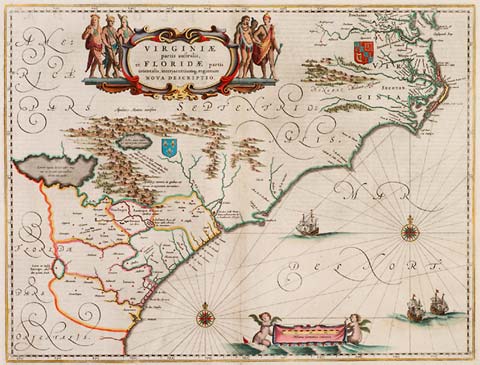
Virginia Partis Australis, et Floridae Partis Orientalis
This item has been sold. Please check our homepage for currently available maps.
Blaeu's landmark map of Virginia and the Carolinas was based on the Hondius map of 1606, but with many improvements based on John Smith's explorations. It contains the first reference to the Appalachians and continued to influence the mapping of the region throughout the 17th century. Item Number: rs1162
Cartographer: Blaeu
Place & Date: Amsterdam / 1638
Size: 20" x 15 1/4"
Condition: Minor spotting along margins; otherwise a beautifully colored, broad-margined exemplar
Price: SOLD