
use +/- or mouse scrollwheel for magnification. click here for full-sized image.
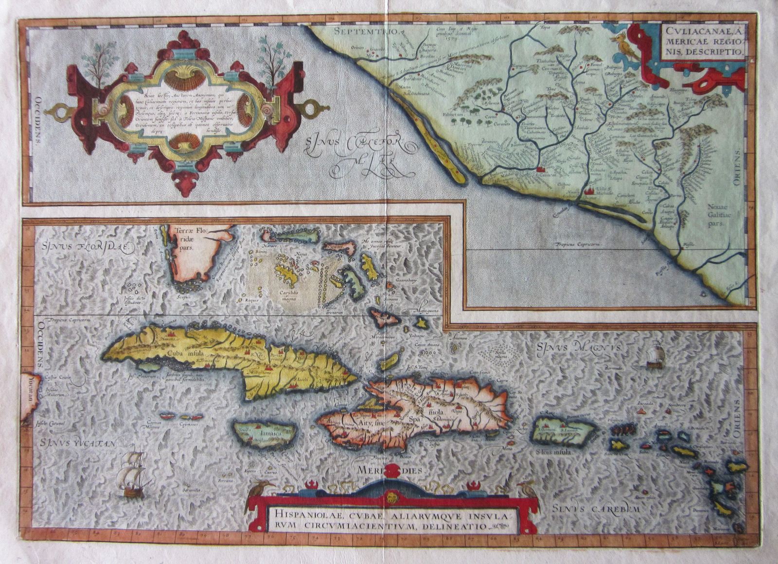
Culiacanae, Americae Regionis, Descriptio./Hispaniolae, Cubae, Aliarumque Insularum Circumiacientium, Delineatio.
This item has been sold. Please check our homepage for currently available maps.
The first printed atlas map of the West Indies, from Cuba to St. Lucia. appears on the same sheet as a map of Culiacan in western Mexico in this important map from Ortelius' landmark atlas, Theatrum Orbis Terrarum. Three superb cartouches enhance the decorative appeal of this marvelous (and beautifully colored) map. Item Number: rs1159
Cartographer: Abraham Ortelius
Place & Date: Antwerp / 1579/1589
Size: 20" x 14 1/4"
Condition: minor spotting in the margins, otherwise a fine exemplar
Price: SOLD