
use +/- or mouse scrollwheel for magnification. click here for full-sized image.
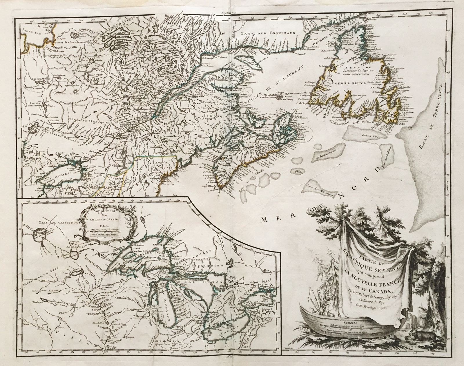
Partie de l'Amerique Septent. qui comprend la Nouvelle France ou le Canada
This item has been sold. Please check our homepage for currently available maps.
Robert de Vaugondy's superb map of French Canada with an inset on the lower left of the still not completely defined Great Lakes. The highly decorative title cartouche features a woodland scene with a canoe and a fierce-looking beaver and in the distance an Indian village. Item Number: ns1598
Cartographer: Robert de Vaugondy
Place & Date: Paris / 1755
Size: 23 5/8" x 19"
Condition: outline color; some water stains on the edges of the wide margins; some paper wrinkling and overprinting.
Price: SOLD