
use +/- or mouse scrollwheel for magnification. click here for full-sized image.
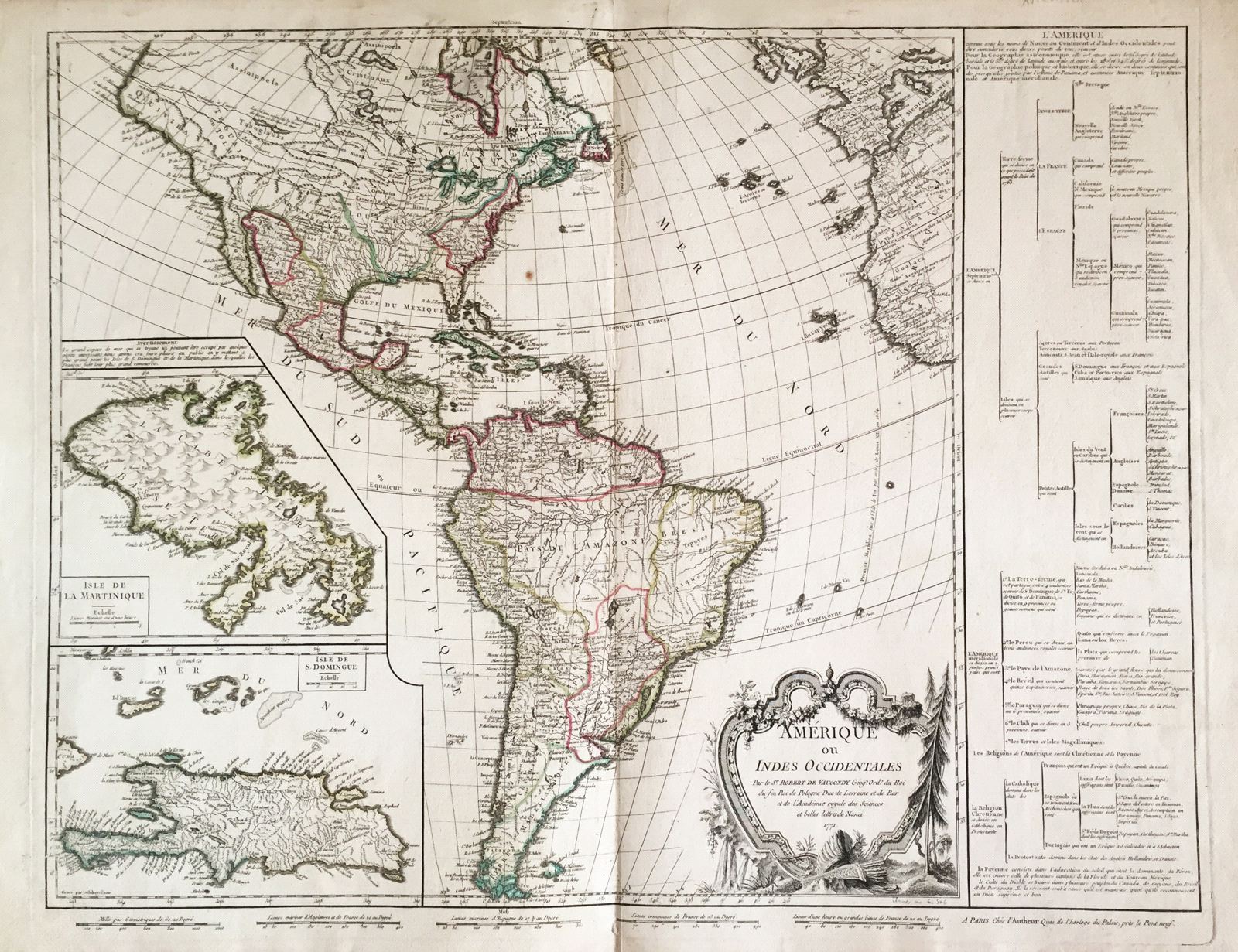
Amerique ou Indes Occidentales.
This item has been sold. Please check our homepage for currently available maps.
Robert de Vaugondy's superb Americas map with large-scale insets of Saint Domingue and Martinique, described as the major centers of French New World commerce. Louisiana is shown dominating North America, while in the oddly contoured northwest, a "Grande Riviere" flows from a salt lake west of the still free-form Rockies to the Pacific. A table to the right of the map lists all American countries and territories and to whos they belong, as well as the major religions of the New World and where they are practiced. The delightful scrollwork and floral cartouche is set in the midst of New World flora, with an Indian headdress and quiver at its base. Item Number: ns1584
Cartographer: Robert de Vaugondy
Place & Date: Paris / 1771
Size: 25" x 20"
Condition: outline color; light overall age toning; minor staining along outer edges of wide margins
Price: SOLD