
use +/- or mouse scrollwheel for magnification. click here for full-sized image.
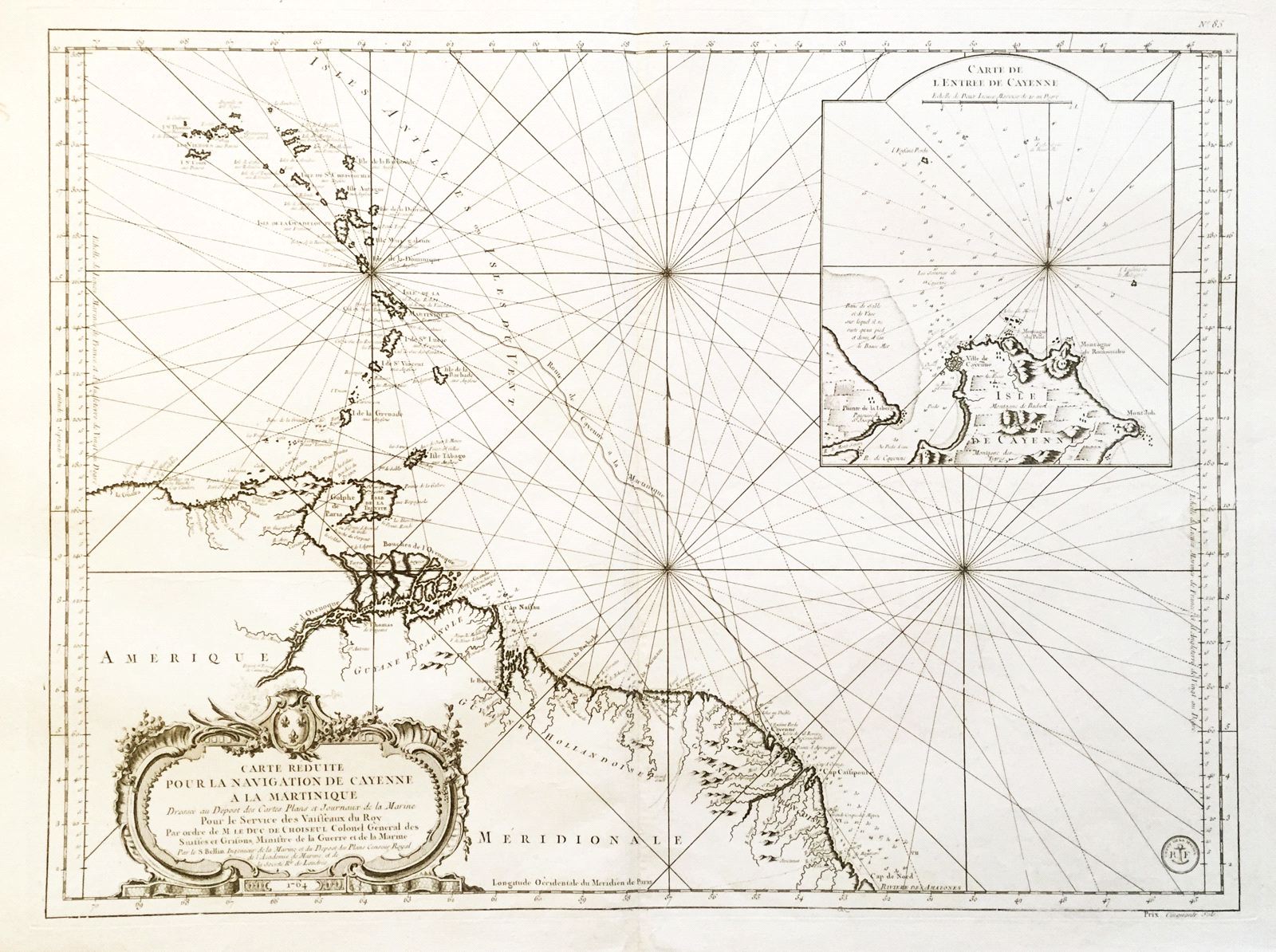
Carte Reduite pour la Navigation de Cayenne a la Martinique
This item has been sold. Please check our homepage for currently available maps.
A later edition of Bellin's magnificent chart of the Lesser Antilles and the northeastern coast of South America focussing on the route between the French colonies of Cayenne (Guiana) and Martinique. The map extends from the Virgin Islands to the coast of South America and includes a detailed inset map of the entrance to Cayenne harbor and an elaborate cartouche. A beautifully preserved exemplar of this superb map. Item Number: h1199
Cartographer: Bellin
Place & Date: Paris / 1764/1790s
Size: 29" x 21 1/2"
Condition: b&w; a strong impression, with some very light overprinting
Price: SOLD