
use +/- or mouse scrollwheel for magnification. click here for full-sized image.
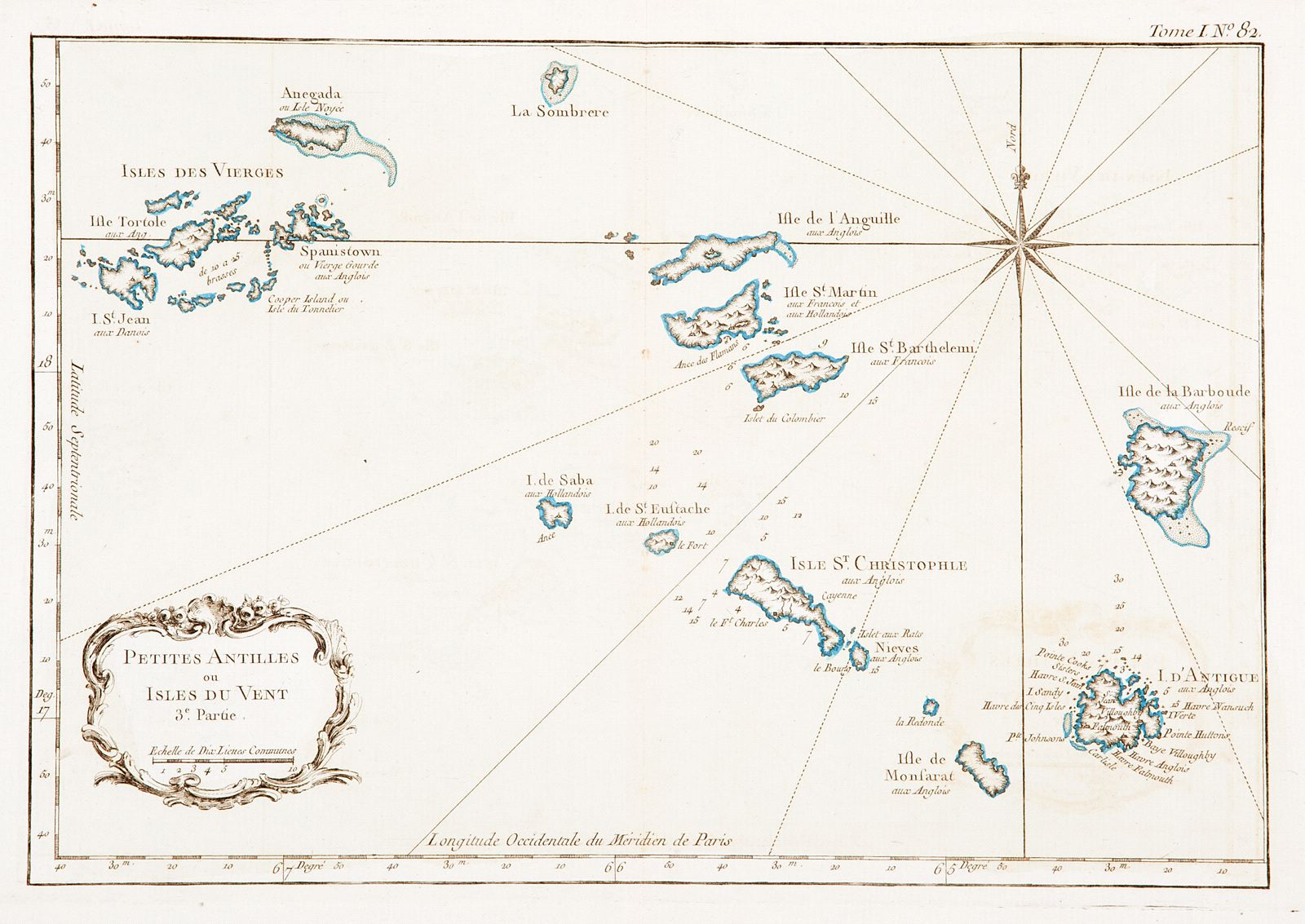
Petites Antilles ou Isles du Vent 3e. Partie
This item has been sold. Please check our homepage for currently available maps.
Part III of Bellin's detailed map of the Lesser Antilles, featuring the Virgin Islands, Anguilla, St. Martin, St. Barts, Saba, St. Eustace, St. Kitts, Nevis, Montserrat, Antigua, and Barbuda, with the colonial power in possession of each island identified. A superb Virgin Islands and Leeward Islands map from Bellin's influential Petit Atlas Maritime. Item Number: gg1834
Cartographer: Jacques Nicolas Bellin
Place & Date: Paris / 1764
Size: 13" x 8 3/4"
Condition: outline and wash color; light overprinting of cartouche; minor browning along outer edges of wide margins
Price: SOLD