
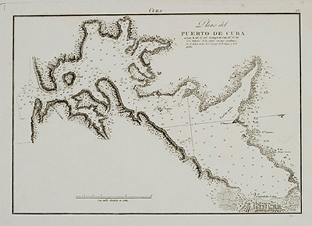
Plano del Puerto de Cuba
This item has been sold. Please check our homepage for currently available maps.
A scarce and highly detailed Spanish Hyrdrographic Office chart of the Port of Cuba, as Santiago de Cuba was called in old maps. In the lower right corner is a plan of part of the city. The multiple depth soundings are in "Castilian feet." Item Number: gg1737
Cartographer: Direccion de Hidrografia
Place & Date: Madrid / 1809
Size: 10" x 7 "
Condition: b&w; minor fraying and light browning in part of the upper margin, otherwise a strong, dark impression in a well preserved exemplar
Price: SOLD