
use +/- or mouse scrollwheel for magnification. click here for full-sized image.
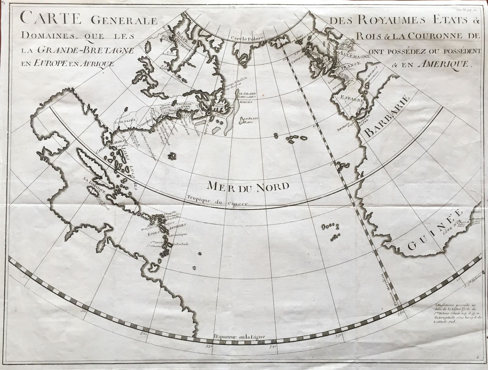
Carte Generale des Royaumes, Etats & Domaines, que les Rois & la Couronne de la Grande-Bretagne ont Possedez ou Possedent en Europe en Afrique & en Amerique
This item has been sold. Please check our homepage for currently available maps.
A scarce and unusual chart of the Atlantic on a conical projection focussing on the "kingdoms, states and domains which the kings and the crown of Great Britain possess or have possessed in Europe, Africa and America. Britain's colonies in North America (prior to the French and Indian War) are outlined and its Caribbean islands are named. On the other side of the ocean, British claims in Germany, France, Spain and Africa are indicated. A fascinating record of Britain's early global expansion. Item Number: gg1716
Cartographer: Rapin de Thoyras
Place & Date: Paris / 1770s
Size: 21 1/2" x 16"
Condition: b&w; folding as issued; a good strong impression; a couple of spots and very light overprinting, otherwise in excellent condition
Price: SOLD