
use +/- or mouse scrollwheel for magnification. click here for full-sized image.
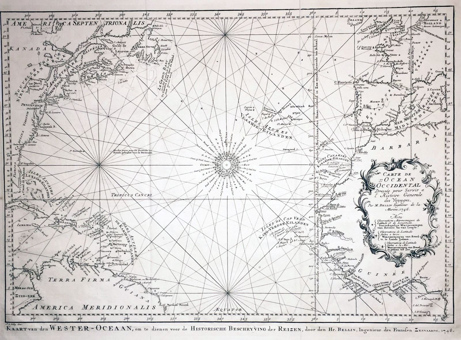
Carte de l'Ocean Occidental
This item has been sold. Please check our homepage for currently available maps.
Bellin's superb North Atlantic sea chart for the Histoire Generale des Voyages, reengraved by vander Shley for the Dutch edition of the influential collection of travel narratives. The chart encompasses parts of four continents—Europe, Africa, North and South America—and all of the Caribbean islands, and is crisscrossed by rhumb lines radiating out from the central compass rose. The west African bulge is dominated by the exquisite title cartouche. A beautifully detailed and engraved chart, in a very well preserved exemplar. Item Number: gg1710
Cartographer: Bellin / vander Schley
Place & Date: the Hague / 1746/1747
Size: 17 3/4" x 12 3/4"
Condition: b&w; overall age toning, folded as issued
Price: SOLD