
use +/- or mouse scrollwheel for magnification. click here for full-sized image.
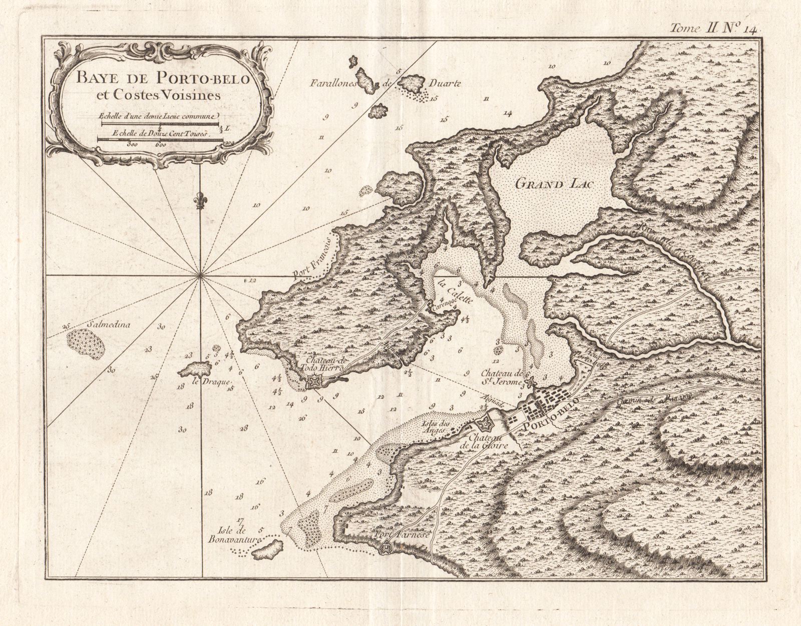
Baye de Porto-belo et Costes Voisines
This item has been sold. Please check our homepage for currently available maps.
Bellin's highly detailed chart of the Bay of Portobello in Panama and its "neighboring coasts" features good topographical and navigational details (shoals, sandbars, and multiple depth soundings), a plan of the town of Portobello and its surrounding forts, and an elegant title cartouche. Item Number: gg1695
Cartographer: Bellin
Place & Date: Paris / 1764
Size: 10 5/8" x 8"
Condition: b&w; a strong dark impression
Price: SOLD