
use +/- or mouse scrollwheel for magnification. click here for full-sized image.
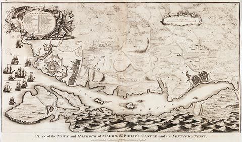
Plan of the Town and Harbour of Mahon, St. Philip's Castle, and its Fortifications.
This item has been sold. Please check our homepage for currently available maps.
A superb plan of Minorca's capital, with its harbor and fortifications. Published in an English translation of Rapin's History of England, the map depicts a British fleet at the harbor's entrance and features a dramatic nautical and military cartouche containing a numbered key to the principal sites of the town and fort. Item Number: gg1379
Cartographer: Rapin de Thoyras / N. Tindal / J. Knapton
Place & Date: London / 1750
Size: 24 1/2" x 14 1/4"
Condition: b&w; small hole in centerfold; repaired split in lower margin; slight overprinting of title; trimmed close at right and left margins
Price: SOLD