
use +/- or mouse scrollwheel for magnification. click here for full-sized image.
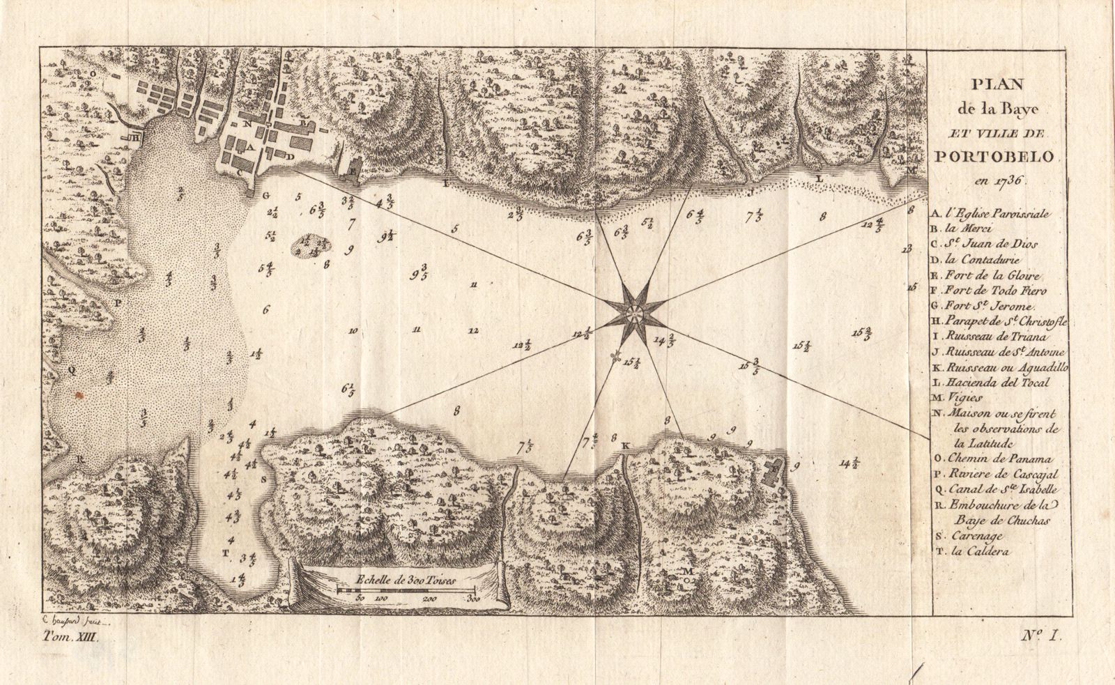
Plan de la Baye et Ville de Portobelo en 1736
This item has been sold. Please check our homepage for currently available maps.
The relatively scarce reduced French edition (engraved by Haussard) of Jorge & Ulloa's plan of the bay and town of Portobelo, with a letter key to the region's natural and man-made features and sites. Item Number: gg1273
Cartographer: Haussard
Place & Date: Paris / 1750s
Size: 8 7/8" x 4 7/8"
Condition: b&w; light overall age toning and a few minor spots and folds as issued
Price: SOLD