
use +/- or mouse scrollwheel for magnification. click here for full-sized image.
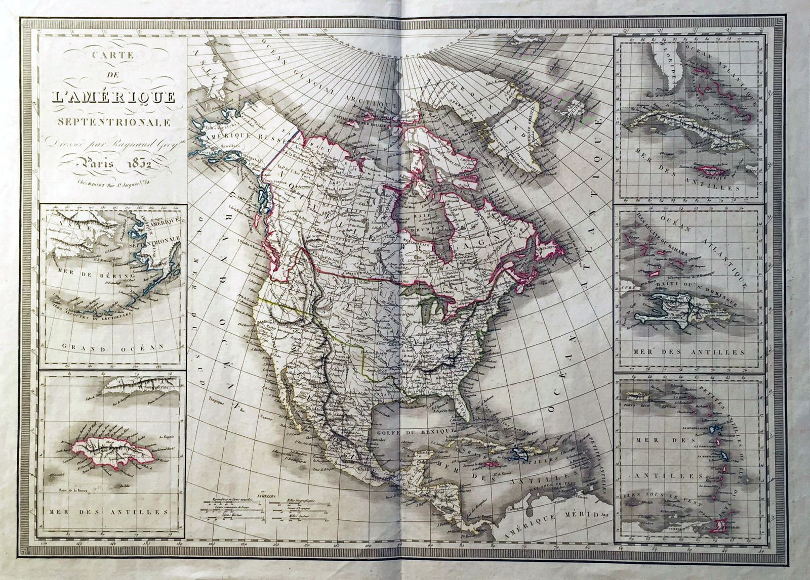
Carte de l'Amerique Septentrionale
This item has been sold. Please check our homepage for currently available maps.
A beautfully designed and engraved map of North America in 1832, with Alaska still part of Russia (Russian America), the US/Canada border still unsettled, and Texas still part of Mexico, with independence still four years away. (Galveston Bay is named, but the city has yet to be founded.) The magnificent main map, with its wealth of place names and topographical details, is surrounded by five large insets: the Bering Sea, Jamaica, Cuba and Jamaica, Hispaniola, and Puerto Rico and the Lesser Antilles. Item Number: W839
Cartographer: Raynaud / Basset
Place & Date: Paris / 1832
Size: 28 3/4" x 20 1/2"
Condition: outline color. tear in upper left margin, repaired.
Price: SOLD