
use +/- or mouse scrollwheel for magnification. click here for full-sized image.
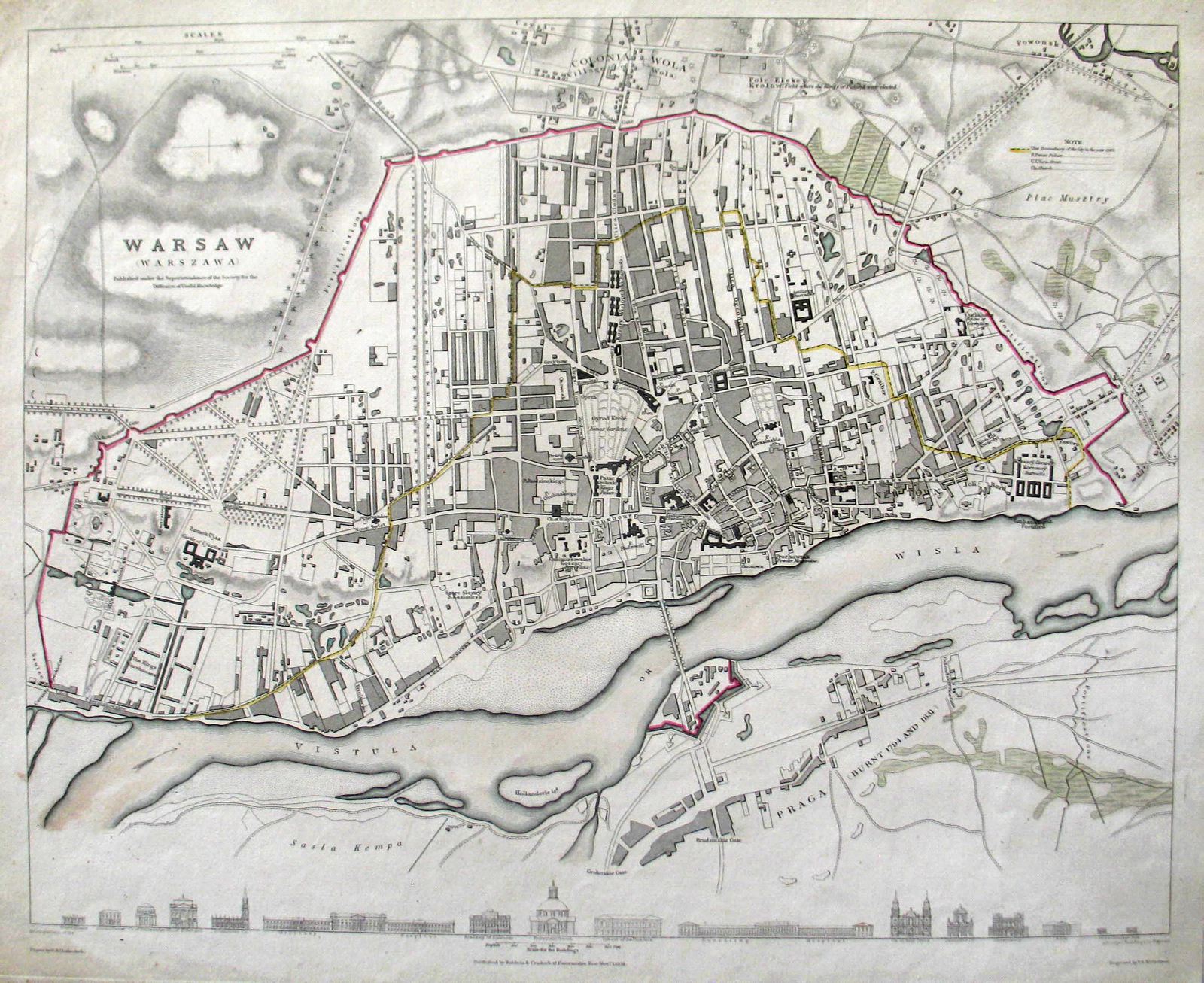
Warsaw
This item has been sold. Please check our homepage for currently available maps.
This meticulously detailed Society for the Diffusion of Useful Knowledge plan of Warsaw, Poland, shows the fortified walls surrounding the 19th-century city and names major streets, public spaces and buildings. The sparsely developed Praga district east of the Vistula River is noted as having burned in 1794 and 1831. The city boundary in 1762 is colored yellow in this exemplar. Along the bottom of the plan are elevation drawings of 16 landmark structures. Item Number: RS2832
Cartographer: Baldwin & Cradock / SDUK
Place & Date: London / 1831
Size: 14 1/2" x 12"
Condition: original outline color (river and city walls); overall age toning; light browning and some staining in margins
Price: SOLD