
use +/- or mouse scrollwheel for magnification. click here for full-sized image.
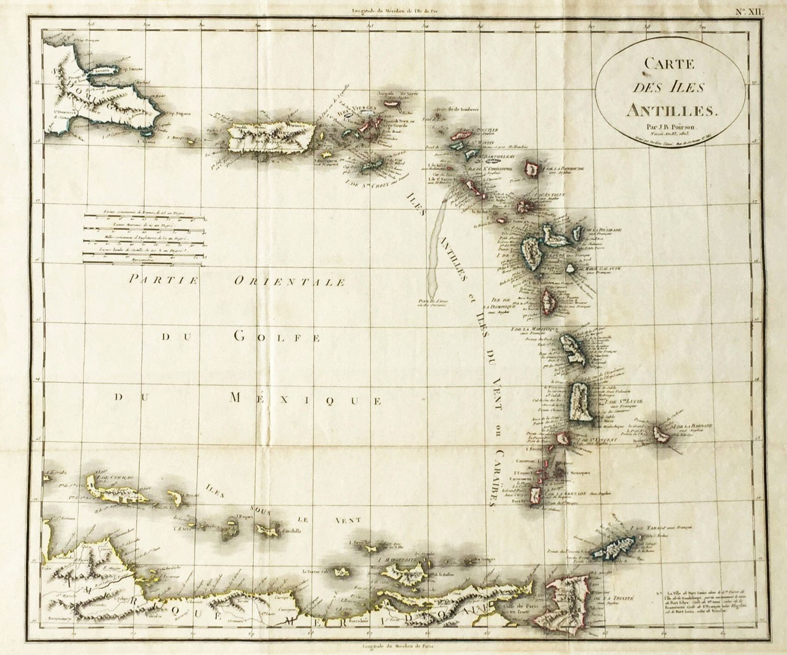
Carte des Iles Antilles
This item has been sold. Please check our homepage for currently available maps.
Poirson's elegant map of the eastern Caribbean, from eastern Hispaniola and Puerto Rico to the northern coast of South America. Includes a color key to the region's colonial powers and a fascinating note on the revolutionary names given to French Caribbean forts and towns during the French Revolution (the town of Port Louis in Guadaloupe became Port Libre, for example, and the town of St. Anne became Fraternite). From the atlas volume of the Statistique générale et particulière de la France et de ses colonies, published by F. Buisson. Item Number: RS2819
Cartographer: Poirson//Tardieu
Place & Date: Paris / 1803
Size: 16 5/8" x 13 5/8"
Condition: folding map; outline color; overall age toning; minor browning and some stains along outer edges of margins.
Price: SOLD