
use +/- or mouse scrollwheel for magnification. click here for full-sized image.
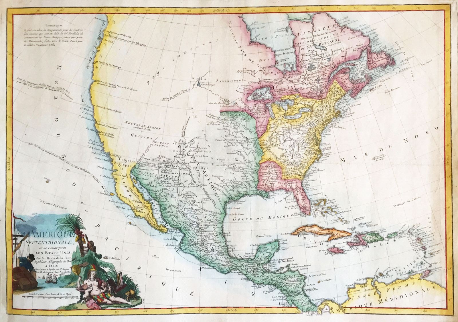
L'Amerique Septentrionale ou se Remarquent les Etats Unis
This item has been sold. Please check our homepage for currently available maps.
The second issue of one of the first maps to name the United States, Brion de la Tour's rare map of North and Central America is an excellent example of the state of geographical knowledge of North America at the end of the 18th century: While the lands east of the Mississippi are highly detailed with many place names and good topography, the regions west of the Mississippi and north of Spanish New Mexico are labeled as "unknown lands." In addition to the route of the Spanish galleons from Manila to Acapulco, the 1783 issue includes the route of Captain Cooke's voyage of exploration of 1778. The superb cartouche features an allegorical figure of America feeding her young amid native flora and fauna and European shipping. Item Number: RS2793
Cartographer: Brion de la Tour
Place & Date: Paris / 1779/1783
Size: 28 5/8" x 19 7/8"
Condition: full wash color; cleaned and sized; minor spotting
Price: SOLD