
use +/- or mouse scrollwheel for magnification. click here for full-sized image.
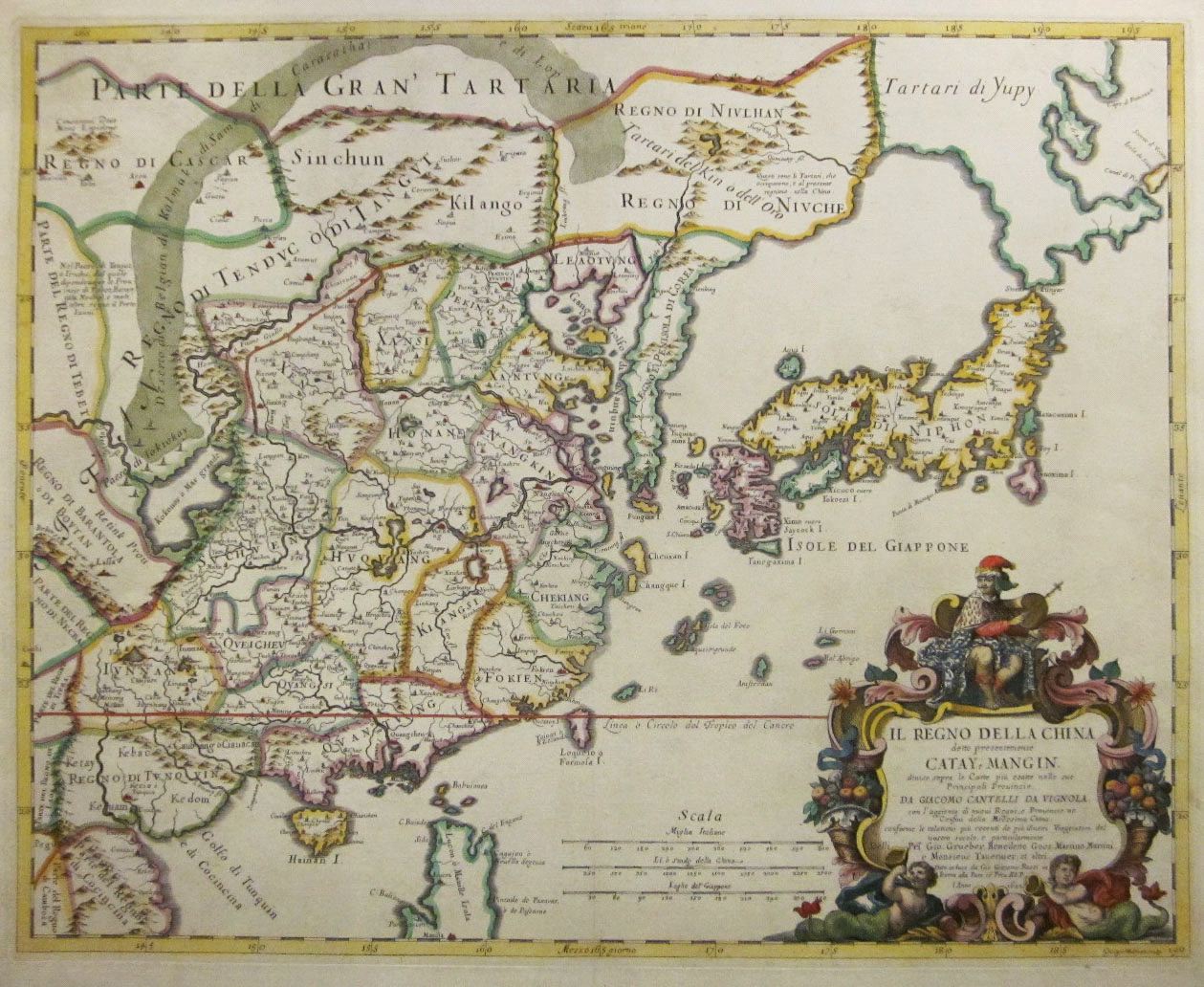
Il Regno della China detto presentemente Catay, e Mangin
This item has been sold. Please check our homepage for currently available maps.
A rare, finely engraved Italian map of China, Korea and Japan with a dazzling title cartouche. In this influential depiction of the Far East, Korea is shown accurately as a peninsula, but the island of Hokkaido has become part of an Asian peninsula called "Tartari di Yupy." The Dutch settlement of New Zealand is shown in Taiwan. The map encompasses the northern part of the Philippine Island of Luzon and the city of Manila (seen perched on the map's bottom edge). A splendidly colored and preserved exemplar of a magnificent China map. Item Number: RS2723
Cartographer: Cantelli da Vignola/G.G. Rossi
Place & Date: Rome / 1682
Size: 21 3/8" x 17 1/4"
Condition: beautifully applied outline and wash color; cleaned and sized; expertly restored tear in lower centerfold.
Price: SOLD