
use +/- or mouse scrollwheel for magnification. click here for full-sized image.
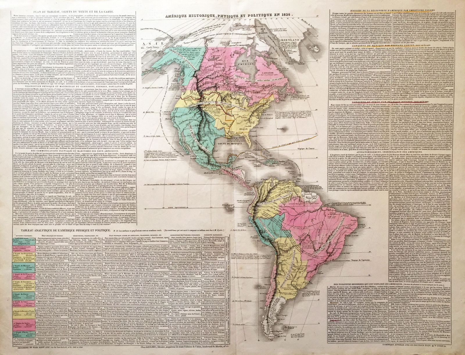
Amerique Historique, Physique et Politique en 1825.
This item has been sold. Please check our homepage for currently available maps.
A fascinating double-folio Western Hemisphere map from the Atlas Geographique, Statistique, Historique, et Cronologique des Deux Ameriques, the French version of Carey & Lea's American Atlas, published in Paris by J. Carez. The highly detailed and accurate map of the Americas in 1825 shows South America divided into the now independent republics of Colombia, Peru, Chile, and la Plata (Argentina); the Empire of Brazil; and the English, Dutch, and French colonies of Guiana. In North America, the Mexican Republic encompasses California, Texas, and the rest of what is now the US Southwest. The U.S. and British North America extend from the Atlantic seaboard to the Pacific, with their current western border fixed. Russian America encompasses Alaska and much of what is now the Yukon Territory and British Columbia. The routes of Columbus from Spain to Hispaniola; Cortez, from Havana to Mexico City; Pizarro, from Porto Bello to Cusco; and the voyage of Lewis and Clark in North America are all highlighted. Surrounding the map on either side are text blocks and charts describing the geography, history, colonization, exploration, population, and political divisions of the hemisphere. Item Number: RS2694
Cartographer: Buchon / J. Carez
Place & Date: Paris / 1825
Size: 26 3/4" x 19 3/8" (overall)
Condition: wash color; light overall age toning; minor browning and fraying along outer edges of margins, otherwise a beautifully preserved exemplar
Price: SOLD