
use +/- or mouse scrollwheel for magnification. click here for full-sized image.
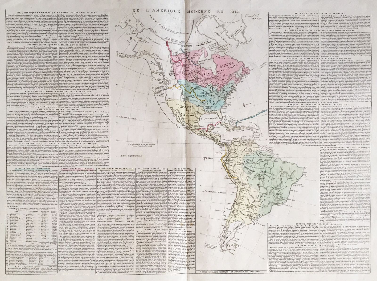
De l'Amerique Moderne en 1812.
This item has been sold. Please check our homepage for currently available maps.
A fascinating double-folio Western Hemisphere map from the Atlas Geographique, Statistique, Historique, et Cronologique des Deux Ameriques, the French version of Carey & Lea's American Atlas, published in Paris by J. Carez. The highly detailed and accurate map of "Modern America in 1812" shows South America divided into Spanish, Portuguese, Dutch, and French territories. North America is divided into British Canada, the "Union Americaine" (both entities extending from the Atlantic seaboard to the Rockies), and Spanish North America, extending from Central America to San Francisco and New Orleans and including Florida; the Northwest and Alaska are left blank. The routes of Columbus from Spain to Hispaniola; Cortez, from Havana to Mexico City; Pizarro, from Porto Bello to Cusco; and the voyages of Lewis and Clark, Mackenzie, and Hearn in North America are all highlighted. Surrounding the map on either side are text blocks describing the geography, history, colonization, exploration, and political divisions of the hemisphere. Item Number: RS2693
Cartographer: Buchon / J. Carez
Place & Date: Paris / 1825
Size: 26 1/4" x 18 1/4" (overall)
Condition: wash color; light overall age toning; minor browning along outer edges of margins, otherwise a beautifully preserved exemplar
Price: SOLD