
use +/- or mouse scrollwheel for magnification. click here for full-sized image.
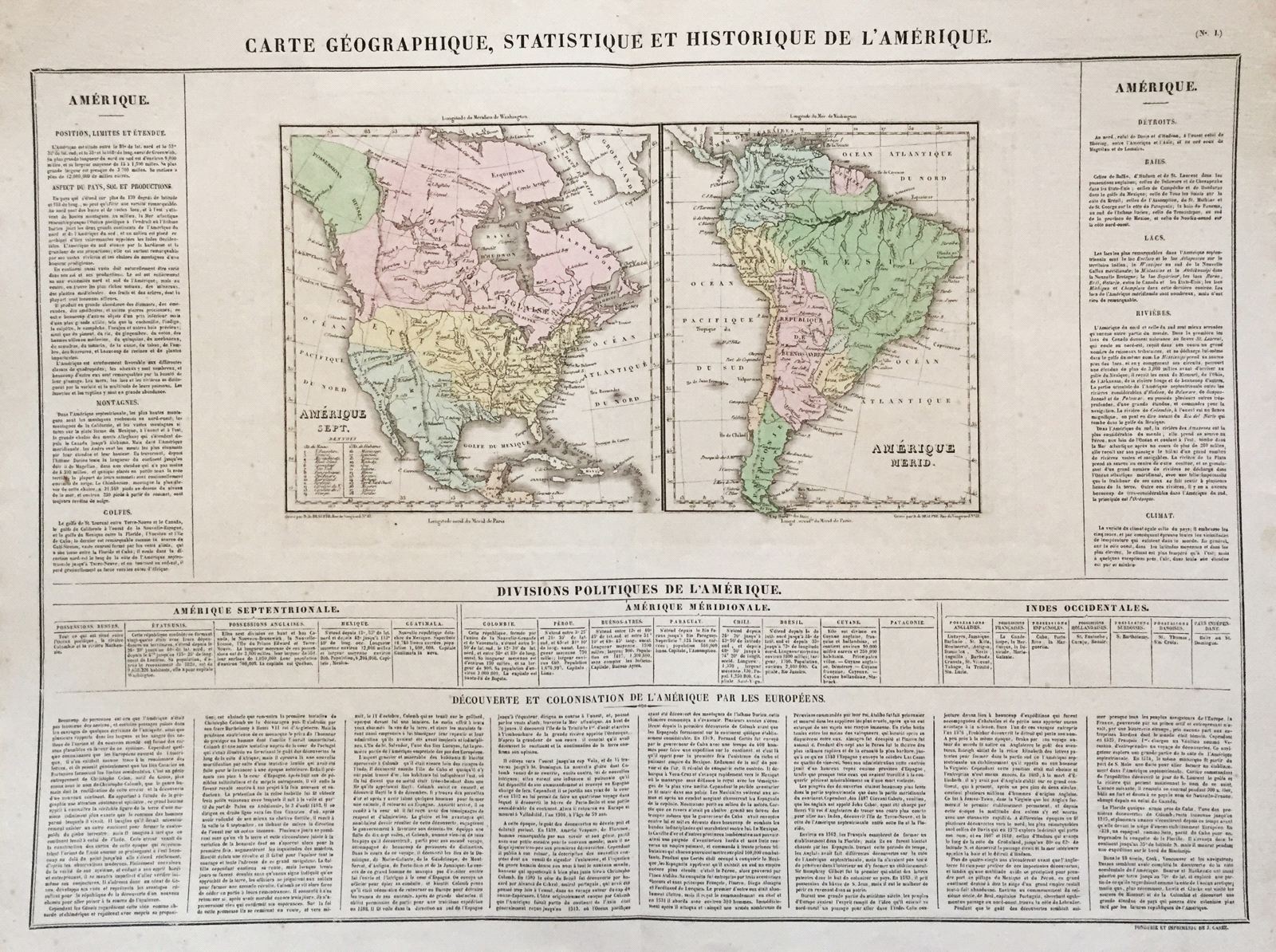
Carte Geographique, Historique et Statistique de l'Amerique.
This item has been sold. Please check our homepage for currently available maps.
Two maps of North and South America on a single sheet from the Atlas Geographique, Statistique, Historique, et Cronologique des Deux Ameriques, the French version of Carey & Lea's American Atlas, published in Paris by J. Carez. The highly detailed and accurate maps show the political divisions of the continents. In the North America map, British claims in the northwest extend down to the Columbia River, encompassing much of what is now the state of Washington; Mexico is in control of the Southwest, from California to New Orleans; and the U.S. states are identified by means of a number key. The maps are surrounded on three sides by text describing the geography, political divisions, and history of the continents. Item Number: RS2692
Cartographer: Buchon / J. Carez
Place & Date: Paris / 1825
Size: 25 3/8" x 18 3/4" (overall)
Condition: wash color; light overall age toning; minor browning and spotting in margins, otherwise a beautifully preserved exemplar
Price: SOLD