
use +/- or mouse scrollwheel for magnification. click here for full-sized image.
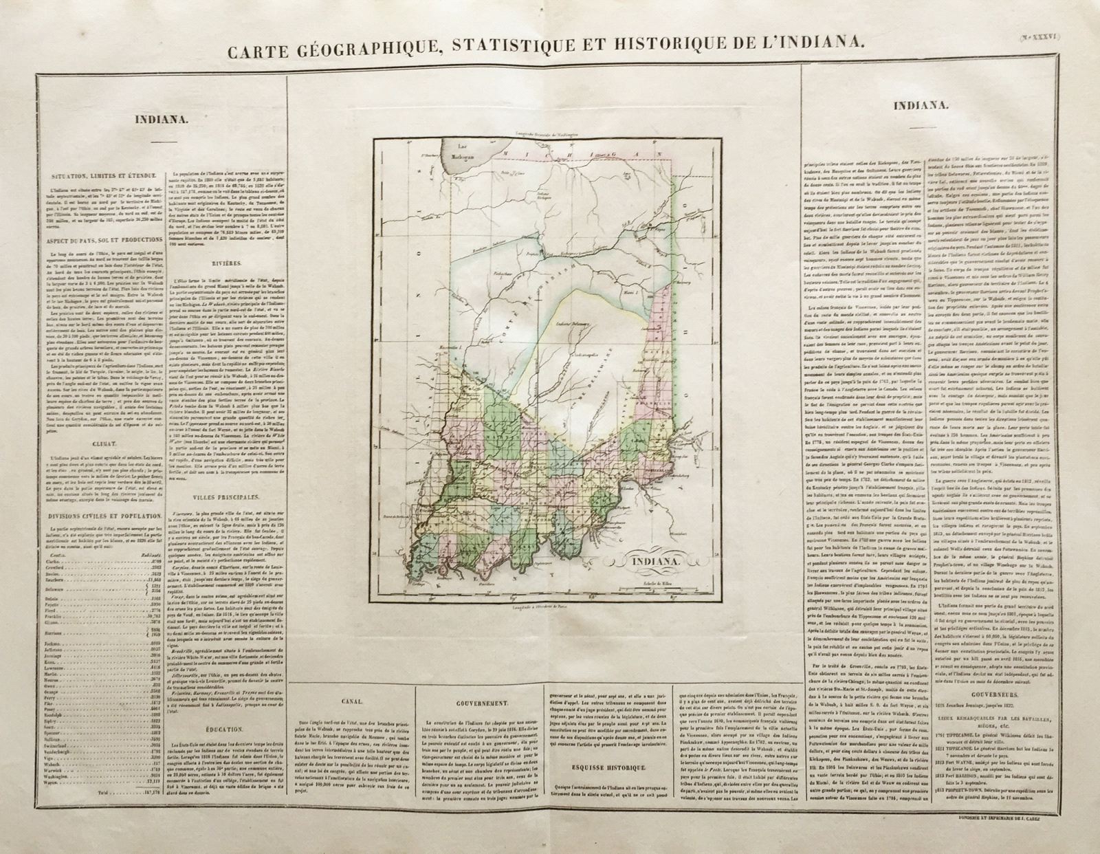
Carte Geographique, Historique et Statistique de l'Indiana.
This item has been sold. Please check our homepage for currently available maps.
The Indiana sheet from the Atlas Geographique, Statistique, Historique, et Cronologique des Deux Ameriques, the French version of Carey & Lea's American Atlas, published in Paris by J. Carez. This was the first separate atlas map of the still largely unorganized state of Indiana. Beautifully colored by county (35 organized counties in the south, the huge Delaware and Wabash counties in the middle, and Kikapoo Indian territory in the north), the highly detailed and accurate map is surrounded on three sides by text describing the state and its geography, principal cities, economy, population, government, history, and famous battle sites. Item Number: RS2683
Cartographer: Buchon / J. Carez
Place & Date: Paris / 1825
Size: 24" x 18 3/4" (overall)
Condition: wash color; light overall age toning; light browning along outer edges of margins; minor spotting in margins; otherwise a beautifully preserved exemplar
Price: SOLD